Heal Somerset
This site does not currently take bookings here on Pitchup.com.
If you are the owner of this site, start taking bookings through Pitchup.com.
It's free, quick and easy!
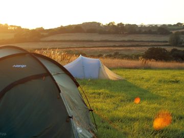
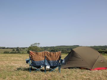
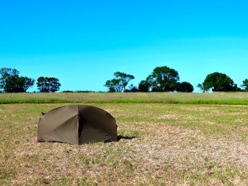
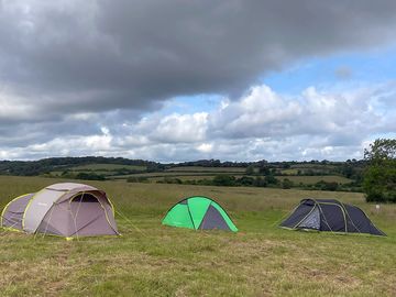
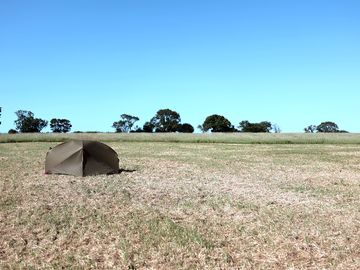
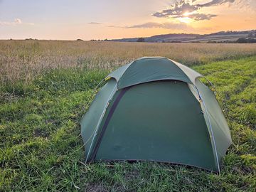
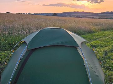
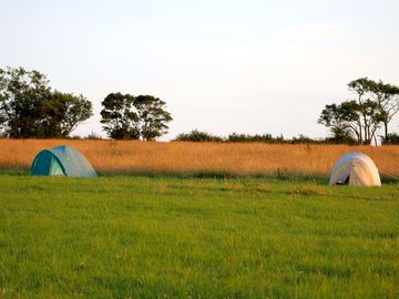
- A wild camping experience in the heart of a Somerset rewilding site
- A tranquil and basic set up, surrounded by wildlife and glorious views
Site type
Languages spoken
![]() English
English
Nearby sites that are bookable on Pitchup.com
Unfortunately, we have no nearby bookable sites.
Want to know more about camping in Somerset?
- 9 Best Places to Walk in Somerset
- Exmoor Area Guide
- 8 Dog-friendly Somerset Beaches
- 5 of Somerset's Best Nature Reserves
- The Best Relaxed Walks on Exmoor
- The 10 Best Beaches In Somerset
- South West England Area Guides
- How To Walk The South West Coast Path On A Budget
- The Ultimate South West England Camping Guide
- Essential camping checklist
- Pitchup camping guide
Features
![]() No dogs allowed
No dogs allowed
Leisure on site
Bar or club house Cycle hire Evening entertainment Fishing Fitness centre Games room Indoor swimming pool Kids' club On-site restaurant/cafe Outdoor swimming pool Play area TV room Take away Tennis WatersportsAmenities on site
Bath available Composting toilet Dog park Drying room Food shop Free wifi Ice pack freezing Internet access Launderette Parent & baby washroom Pick-up from public transport Portable toilet Pub toilets Public telephone Shower available Toilet block Washing-up area WifiGroups welcome
D. of E. welcome Family friendly Motorcycle friendly Single-sex groups welcome Student groups welcomeRules
Barbecue provided Barbecues allowed Campfires allowed Commercial vehicles allowed Dogs allowed No dogs allowed No pets allowedThemes
Budget/backpacker Peaceful Spectacular scenery Walkers' paradise Wild camping Wildlife havenUtilities
Charging facilities Chemical disposal Electric car charging point(s) Gas cylinders available Recycling available Renewable energyNearby amenities
Bar nearby Dog walk nearbyLocation
Heal Somerset
Lower West Barn Farm
Bindon Lane
Frome
Somerset
England
BA11 5HH
Timezone
Europe/London BST (GMT+01:00)
GPS
51.1592°N
2.37805°W
Route directions
Nearest transport
Please note: All distances on this page are calculated "as the crow flies" - please check actual distance depending on your mode of travel using the Get directions button above.
Local attractions
Water quality at nearby bathing waters
| Name | Distance | Type | 2020 | 2019 | 2018 | 2017 |
|---|---|---|---|---|---|---|
| Clevedon Beach | 28.5 mi | Estuary | N/A | Good | Good | Good |
| Weston-Super-Mare Uphill Slipway | 28.8 mi | Estuary | Poor | Poor | N/A | Poor |
| Berrow North Of Unity Farm | 28.9 mi | Estuary | N/A | Excellent | Good | Good |
| Weston Main | 29 mi | Estuary | Poor | N/A | Poor | N/A |
| Weston-Super-Mare Sand Bay | 29.1 mi | Estuary | N/A | N/A | Good | Good |
Data source: European Environment Agency
Must see
Stourhead House and Garden 4.4 mi
Longleat 4.7 mi
Haynes International Motor Museum 11.3 mi
Wells Cathedral 12.1 mi
Ebbor Gorge National Nature Reserve 12.6 mi
National Trust
Stourhead 4.5 mi
West Pennard Court Barn 11.9 mi
Westwood Manor 12.6 mi
Prior Park Landscape Garden 14.2 mi
Lytes Cary Manor 15.4 mi
Cycle routes
Find local routes on the National Cycle Network - over 12,000 miles of cycling routes.
Other
MARSTON HOUSE 3.4 mi
Tytherington - Trudoxhill - Macmillan Way South 3.8 mi
STOURHEAD 3.8 mi
Maiden Bradley - Forest Road - Gare Hill 4.1 mi
THE CHANTRY 4.2 mi
Please note: All distances on this page are calculated "as the crow flies" - please check actual distance depending on your mode of travel using the Get directions button above.
Reviews
No reviews yet.
Frequently asked questions
- Does Heal Somerset have a swimming pool? No View all features
- Is Heal Somerset dog friendly? No View all features
- What attractions are near Heal Somerset? Although we are a rural site, we are well located with several attractions and activities near by. Bruton is a 15 minute drive away and has Hauser & Wirth Somerset art gallery … Read more
- When can I check in and check out of Heal Somerset?
Camping and touring Arrive: 12 p.m. – Anytime Depart by: 11 a.m. We strongly recommend that you do not arrive as it is getting dark – there are no lights on the site and it could be pitch black and putting up a tent could be very challenging. We strongly recommend you bring a torch in case your phone has run out of battery. However, if a late arrival is unavoidable, please call 01749 684
Read more