Best Walks And Trails In Cambridgeshire
You may think of Cambridgeshire as an ancient seat of learning from which some of the greatest minds in history have sprung. Yet, there’s something wonderfully earthy and blunt about the names of places in this part of East Anglia.
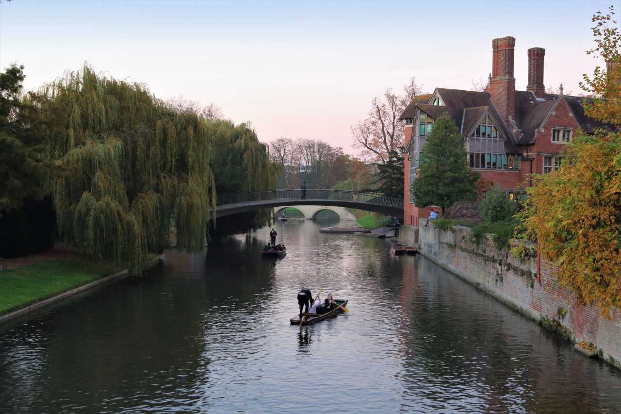
If you’re gazing up at the Romanesque, Renaissance, Neoclassical, Neo-Gothic and Modern architecture of Cambridge University, chances are you’re standing in ‘The Backs’, from where the rear of the colleges, well, back onto the river.
Indeed, so preoccupied was the collective city wisdom of Cambridge that they forgot the name of its river. Even then, they were too busy philosophising, so they called it the Cam for ease - and because it had a grand bridge the name Cambridge just made sense. (The river was really called the Granta and had been known as this for centuries…)
You’ll pick up on this trait more as you stroll through the fresh air of the fenlands, ancient woodlands, lakes, riverways, country parks and traditional villages in this most English of counties. Pull on your boots, adjust your hiking socks, and sling on your backpack for the best walks and trails in Cambridgeshire.

Along the River Cam from Cambridge to Grantchester
From the spires of Cambridge to the thatched cottages and gardens of Grantchester, this route along the River Cam is a popular one for punting along the waterway, and can also be done on foot in an hour or so. Start in the city centre, near the railway station, then head down Station Road and take a stroll through The Backs to the river, which will reveal signposts directing walkers and cyclists to Grantchester.
The meadow-lined riverbanks make a great spot for a picnic, or simply to watch the boats go by as willows nod into the water. The walk passes by the puzzling Grade II-listed Mathematical Bridge and then several nature reserves, before reaching the Eight Acre Wood. Here there are views of Grantchester Meadows as you approach the village itself. It's a tradition (almost mandatory, in fact) to complete this walk with high tea at the Orchard Tea Garden. For something more substantial, the three pubs in Grantchester – the Rupert Brooke, the Blue Ball Inn and the Red Lion – are as appealing as they appear on the TV series that’s set here.
Book your stay at a cheap campsite in Cambridgeshire
Anglesey Abbey
Anglesey Abbey is a Jacobean National Trust property that’s now no longer an abbey or anywhere near Anglesey (which is about 250 miles away on the north coast of Wales). The site is actually between Cambridge and Newmarket, with a mansion house on the site of a former priory, and the surrounding parkland has lots of walking opportunities.
A most pleasant circular walk of around six miles takes in the splendour of the gardens and landscaped grounds before heading along ancient green lanes once used by drovers to move livestock. The return leg, via the riverbanks of Quy Water, picks up a section of the Harcamlow Way.
Stay near Anglesey Abbey at a campsite near Newmarket
The Hills and Holes of Barnack to Burghley House
Hills are a rarity in this flat land but holes were once dug all over Cambridgeshire – and the Hills and Holes Nature Reserve obviously has both. Once the site of a medieval quarry, the area’s undulating mounds grew up where the old diggers shoved the bits they didn’t want while extracting limestone from the ground.
You can happily wander along several paths through the nature reserve, keeping an eye out for all sorts of insects, wildflowers, scrubland and trees. Or for a longer walk, head for the hilly part of the Hills and Holes of Barnack and then on to Burghley House, a Tudor mansion in Stamford with extensive parkland. To make this a circular walk, aim for the railway on your way back from Stamford and follow the Torpel Way to Barnack.
Linger a while longer with a stay at these campsites near Stamford
Wicken Fen
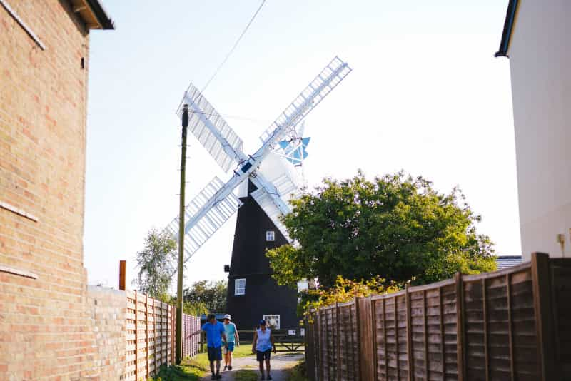
Located between Ely and Cambridge is Wicken Fen, a National Trust nature reserve that was in fact the very first to enter into the hands of England’s conservation guardian. Wicken Fen has abundant wildlife in its wetlands, meadows, reedbeds and lakes. It also has a network of walking and cycling trails, including a mile-long boardwalk route that suits any ability, plus longer trails for those feeling energetic. Follow in the footsteps of Charles Darwin who, as a young man, collected beetles on Wicken Fen, and pass by the still-working windpump built in 1912 to drain the land.
Unwind at a holiday park near Ely 
Paxton Pits to St Neots
Paxton Pits is another reclaimed quarry that’s now been flooded and given back to nature. This Site of Special Scientific Interest is a haven for wildlife and is likely to delight birdwatchers. Wintering wildfowl gather upon the waters, and you might spot nightingales and hear cuckoos up in the trees. The local wildlife trust manages the site and there are paths throughout, including a circular trail that will take around an hour and a half to walk. To make a day of it and add in the pleasures of St Neots, follow the watercourses of the pits to Rudd Lake and then Little Paxton before a walk along the eastern banks of the Great River Ouse all the way to the town.
Houghton Mill to St Ives on the Ouse Valley Way
The Ouse Valley Way is a long-distance trail that begins at the source of the River Great Ouse in Northamptonshire and ends at The Wash near King’s Lynn. 26 miles of the route pass through the historic county of Huntingdonshire (now part of Cambridgeshire). A lovely circular walk of five and a half miles starts at Houghton Mill (once a mill, then a youth hostel and now owned by the National Trust), passes through the charming Hemingford villages, and arrives at the market town of St Ives.
The route follows riverbanks, crosses water meadows, passes wonky thatched cottages, stops at ancient churches and wanders along country lanes with suitably charming names (think Love Lane, Meadow Lane, Thickett Lane and others. For more info and directions, check out the National Trust page which tells you all about the walk.
Book yourself in to one of the best campsites in St Ives
The Cambridge Commons
Cambridge is surrounded by several areas of common land, each highly suitable for exploring and walking. These are places where you can swap the crowds of the city for the herds of cows that still roam the public open spaces. Where other towns and cities in England largely lost their grazing cattle as the gentry enclosed areas into private ownership, the scholars of Cambridge had more interest in academia than acquiring land.
There are lots of named commons in Cambridge. The most well-known are Stourbridge Common, Jesus Green and Lammas Land. To this day, Stourbridge Common hosts the annual Midsummer Fair, once the largest such festival in medieval Europe. Jesus Green has one of the few remaining 1920s lidos, next to the River Cam and boats navigating Jesus Lock. Lammas Land is an area of city park, so named from the Saxon festival of 'hlafmaesse' ('Loaf Mass') celebrated on 1 August, when bread made from the first harvest would be ritually blessed.
There are lots of walks on the commons, so you can either stroll through the features of each one, use them as start and end points to explore the wider Cambridge area, or link a few together. If you’re exercising your right to roam, just remember the herds have ancient permissions to do just the same. And it’s not uncommon to find the nosy beasts of the commons wandering right into downtown Cambridge.
![A Cambridge cow taking a nosy at what the tourists are up to] A Cambridge cow taking a nosy at what the tourists are up to]](/cdn-cgi/image/format=auto,quality=50/images/image/private/s--c75JEube--/c_scale,w_800/v1627310968/vitor-avila-m56PaieHC34-unsplash_ei4ehg.jpg)
Check out campsites and holiday parks near Cambridge
If you’re looking for more things to do in the area, then read about the best things to do in Cambridgeshire to make your stay all the more memorable.
Cambridgeshire is one of the four counties that loosely make up the traditional region of East Anglia. Take a moment to read through our complete guide to camping in East Anglia for everything you need to know from booking a break to pitching a tent for the first time.