Camping on the North Downs Way
Following a medieval pilgrimage route through the Surrey Hills and Kent Downs Areas of Outstanding Natural Beauty, the North Downs Way is a well-walked, 153-mile hiking and camping trail. It wends its way across chalk downland between Farnham and Canterbury, and you can add on a circular spur that takes in Dover and the famous White Cliffs.
Camping en route is the best way to enjoy the spectacular countryside at your own pace. You can find out more about the route in this article, and see your options for overnight camping spots. We’ve added details of some of the North Downs Way’s most interesting sights as well as practical tips to make your trip a success.
Camping accommodation
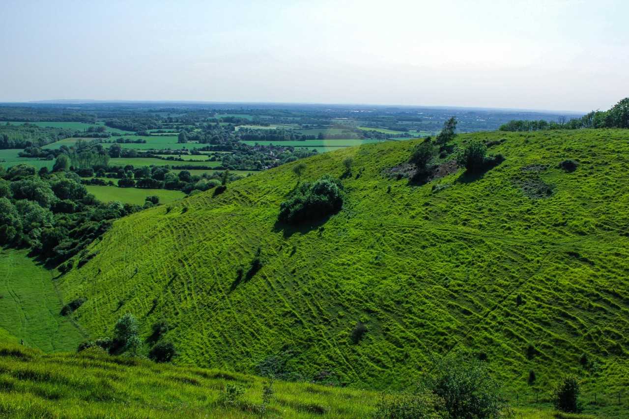
A camping trip is one of the most popular ways to see the glorious chalk escarpments of the North Downs Way. There are plenty of designated camping options along the route, including glampsites if you prefer a few luxuries with your overnight stops.
To see the camping options available along the North Downs Way, simply click the link under each day’s itinerary. This is a popular hiking route, so it's likely that sites will get booked up well in advance. Do your research and book your pitch early, especially in summer, so you’re guaranteed an overnight stay at the handiest sites.
There’s no need to carry any heavy camping gear either, as plenty of companies will move your baggage from campsite to campsite for you.
Route map
What can I see along the North Downs Way?
There are plenty of attractions – from amazing views to ancient castles and wildlife parks – to see along the North Downs Way. Here are five attractions you should try not to miss.
1. Box Hill
The highest point of Surrey’s chalk downs, noted for orchids and other rare plants as well as far-reaching views and a steep climb popular with road cyclists. There’s also the Box Hill Natural Play Trail for kids.
With origins in the 11th century and built to guard the River Medway from attack, this massive stone fortress is open for walking tours of its keep and grounds. There are battle enactments and outdoor theatre performances in summer.
3. Leeds Castle
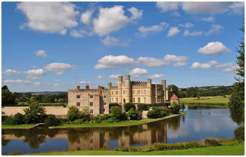
With hundreds of years’ worth of history, moated and spectacular Leeds Castle was once briefly home to Henry VIII and Catherine of Aragon. Today it’s a great day out for families, with formal gardens to explore, a maze and guided tours of sumptuous apartments.
An extensive wildlife park dedicated to the conservation of endangered species, including gorillas, black rhinos and snow leopards. You can also follow replica dinosaurs on a woodland walk or try your hand at treetop rope courses.
Site of the untimely assassination of Archbishop Thomas Becket in 1170, the cathedral is a famous pilgrimage destination. It is open for guided tours, taking in its magnificent Norman architecture as well as its medieval stained-glass windows.

An itinerary for the North Downs Way
Here is a guide to what you can expect to achieve each day when walking along the North Downs Way, with each day ending near a village or town with camping accommodation, pubs and shops nearby.
Break your journey to Farnham and camp overnight locally to the North Downs Way. Watercress Lodges Campsite at Ropley on the Hampshire border has family-friendly and spacious pitches, while Runway’s End Outdoor Centre offers compact wooden pods (no need to pitch a tent) and a quiet position on the Basingstoke Canal.
If you stay near Farnham, it's a good idea to stock up at the supermarkets before starting the walk.
Day One – Farnham to Guildford (11 miles)
The walk starts off by the side of the A31, and heads eastwards to meet the ancient Pilgrim’s Way.
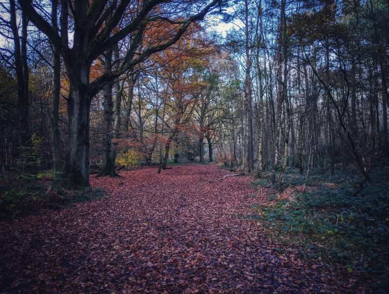
Sights to watch out for include deer and rich birdlife in Runfold Wood Nature Reserve, lovely old houses in the village of Puttenham and spectacular Surrey Hills views.
Arriving in Guildford, there are plenty of campsites around the city's outskirts as well as shops and dining options.
Day Two – Guildford to Westhumble (13 miles)
Starting out on the Pilgrims Way, today you’ll pass the 12th-century hilltop church of St Martha-on-the-Hill. You’re soon out on the chalk Downs, with views to Greensand Ridge, the High Weald and South Downs. Further on, the National Trust-owned Netley Park is a wooded estate with a Georgian mansion once home to the Canadian Army in World War II.
The pretty village of Westhumble has a few camping options nearby as well as a couple of shops for essentials and a pub.
Day Three – Westhumble to Merstham (10 miles)
Today is the day to cross the famous stepping stones over the River Mole and climb to the summit of Box Hill for Surrey Downs views. More climbs follow, up Colley and Reigate hills, with views of the restored Reigate Fort from the latter.
You’ll end the day in Merstham (have a look at its Tudor-era houses before you leave) as your overnight stop, with a few shops and pubs.
All our campsites near Merstham
Day Four – Merstham to Oxted (eight miles)
Out of Merstham, it’s a steady climb up the ridge for hiking through farmland – keep an eye out for Whitehill Tower. The route loosely follows the M25 so you may hear traffic noise, but there’s plenty of woodland to disappear into around Gravelly Hill – plus Oxted has some great pubs for when you finish this short leg.
Day Five – Oxted to Otford (12 miles)
Steep climbs and fantastic Downs views today, as you walk over the Surrey border into Kent, with much of the route passing through open farmland. From here, the trail travels on through the Kent Downs Area of Outstanding Natural Beauty.
Charles Darwin’s Down House and Sir Winston Churchill’s former home at Chartwell can both be visited from this section of the North Downs Way.
Otford is the overnight stop – this lovely half-timbered village is home to the ruins of the Tudor-era Hidden Palace as well as tearooms, pubs and shops.

Day Six – Otford to Cuxton (15 miles)
Setting off from Otford, the route is back on the Pilgrims Way, passing through Kemsing Down Nature Reserve and the chalk grassland of Trosley Country Park, both known for rare orchids and butterflies. If you are hiking in spring, the woods hereabouts are carpeted in bluebells.
In Cuxton, there are a couple of pubs on the River Medway as well as convenience stores for self-catering supplies. Oakview Holiday Park is a peaceful woodland camping site near Detling, while Still Acres Touring and Camping Park has hot showers to relax in after a day’s hiking.
Day Seven – Cuxton to Hollingbourne (16 miles)
Heading out of Cuxton, it’s time to cross the River Medway, with Rochester Castle and the cathedral soon in sight. The trail also takes in Kit’s Coty House, a Neolithic burial chamber, before ending up in peaceful Hollingbourne, a village with post office stores, coffee shops and choice of pubs.
If you fancy a day off from walking, moated Leeds Castle, with its maze, royal apartments and falconry shows, is a half-hour’s walk from the village.
Which North Downs Way loop to choose?
For the final three days of your hike, there are two choices for the route from Hollingbourne to Dover.
Both have camping options en route to allow you to relax and enjoy the scenery after a long day’s hiking, so to help you make a decision on which route to take, we have provided a sample itinerary for both.
-
The Northern Loop: This is 46 miles long and follows the original Pilgrim’s Way closely, taking you via Canterbury.
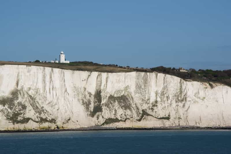
- The Southern Loop: This option is 45 miles long and offers spectacular views over the White Cliffs of Dover.
Northern Loop route map
(via Canterbury to Dover)
Day Eight – Hollingbourne to Boughton Lees (15 miles)
Leaving Hollingbourne via The Dirty Habit pub, the walking is mostly on tracks and tarmac trails across relatively flat farmland.
The trail soon separates at a signpost, heading either to Canterbury or on to Dover. Follow the Canterbury sign. From here, you’ll have plenty of walking on gravel tracks and drovers’ roads, heading past 'Percy the Pilgrim', a wooden sculpture perched on a bench, and a massive chalk cross near Lenham.
Boughton Lees has a proper village green, plus a couple of pubs serving food all year around.
Day Nine – Boughton Lees to Canterbury (12 miles)
Much of the route is through The King’s Wood, once notorious for robbers preying on the devout following the Pilgrim’s Way to Canterbury Cathedral.
Stop off to admire the pretty village of Chilham before heading towards Canterbury, walking through orchards and farmland. St Dunstan’s Church marks the final approach into the city, and many pilgrims used to walk barefoot to the cathedral from there.
Today’s route finishes at Canterbury Cathedral. The city is well supplied with dining options and there are plenty of camping options close by, including Goldpark Leisure, where you can pitch your tent and enjoy views of the chalk downs, and Sandwich Lakes, with peaceful picnic spots overlooking trout lakes.
Day 10 – Canterbury to Dover (19 miles)
The long but easy hike to Dover starts on farmland along the Elham Valley Way and takes in numerous pretty hamlets, passing St Augustine’s Abbey and the village of Shepherdswell.
Today you can make a detour to Howletts Wild Animal Park, to see elephants and gorillas in expansive enclosures.
The final approach to Dover is a gentle countryside stroll with distant sea views, before the route emerges with the White Cliffs Country Trail, leading along the White Cliffs and with views to Dover Castle. The official end of the walk is along the seafront, with plenty of pubs and cafés nearby.
Southern Loop route map
Option Two – Southern Loop
(via Folkestone and the White Cliffs to Dover)
Day Eight – Hollingbourne to Wye (22 miles)
Leaving Hollingbourne via The Dirty Habit pub, the walking is mostly on tracks and tarmac trails across relatively flat farmland, and this is one of the longest days on the hike.
The trail soon separates at a signpost, heading either to Canterbury or on to Dover. Take the route towards Dover (or skip to Option One – Northern Loop) and head on to Wye, another charming village with a choice of pubs, plus shops if you need to stock up.
Spend the night under canvas with a wild-camping vibe in woodland at Woodsman Kent Wild Camping and Glamping or enjoy views over the glorious Kent Downs from the pitches at Little Lynton Acres.
Day Nine – Wye to Etchinghill (11 miles)
Leave Wye through the churchyard and soon there are steep ascents leading to Downs views. The first climb of the day leads up to the Wye Crown, carved into the chalk hillside in 1902, where the North Downs Way was officially opened in 1978.
On a clear day you can glimpse the sea from up here on the Downs, and look out for the Devil’s Kneading Trough, a steep limestone combe with more spectacular Kent views, plus Tolsford Hill BT Tower in the distance.
Etchinghill village offers a few amenities for overnight campers, including pubs and a couple of farm shops.
Day 10 – Etchinghill to Dover (12 miles)
Walking up onto the escarpment just north of Folkestone, you’ll soon spot the English Channel and the Channel Tunnel Terminal, as well as pill boxes left over from World War II and the White Horse at Cheriton Hill.
From there, the route skirts Dover, passing along the famous White Cliffs to the Battle of Britain Memorial, and on for amazing views over Dover Castle from the Western Heights.
This loop of the North Downs Way officially ends on the seafront, and the town has plenty of facilities like shops, pubs and cafés.
Check out our campsites near Dover
Planning for the North Downs Way
Here’s some practical information to help plan your walk.
What to pack
Here’s a list of what to carry when backpacking – and if you’ve never stayed under canvas before, have a look at Pitchup’s advice for first-time campers.
When to go
-
The weather in England – even in summer – is always unpredictable, so whenever you decide to hike the North Downs Way, you might get rain and sunshine in one day.
-
It’s pleasant to walk the trail in spring and autumn as it is fairly quiet. It gets very busy during school holidays in the summer, and although many campsites stay open over winter, you can expect shorter daylight hours and some mud along the path.
Staying safe on the hike
The North Downs Way is an easy-to-moderate hike, but you still need to be cautious, especially if you are solo camping.
-
Let someone know where you are and where you will be camping that night, so the alarm can be raised if you are a no-show.
-
Even though the trail is very well signposted, have a basic knowledge of map reading.
-
Carry a basic first-aid kit (including lots of blister plasters).
-
Contact 999 or 112 in an emergency, and pinpoint your position with the what3words app.
North Downs Way camping FAQs
Is wild camping allowed on the North Downs Way?
Wild camping is illegal in England, and luckily the North Downs Way has plenty of official campsites.
Some landowners and pubs may allow you to camp on their land for a fee, but always ask before you set up camp. Never pitch close to houses, in crop-sown fields or in fields with livestock.
How long is the North Downs Way?
The North Downs Way is 153 miles long, stretching from Farnham to Canterbury across chalk downs, with an optional circular spur taking in the White Cliffs of Dover. To do justice to the route and the countryside, aim to take around 10 days to complete the walk.
Can I camp on other walks direct from the North Downs Way?
The 37-mile Downs Link connects the North Downs Way with the South Downs Way between St Martha’s Hill and Steyning.
Is the North Downs Way OK for kids?
This walk is pretty flat and mostly on paved paths, so it’s suitable for family hiking. There’s loads to see on the route, and you can also do the walk in bite-size sections, perhaps opting to camp out for a couple of nights if you have younger kids.
Which way should I walk the North Downs Way?
Most people walk from west to east, but hikers coming into Dover from Europe can easily pick up the route there and walk the opposite way.
How do I get to the start of the North Downs Way?
Good train, bus, coach and road services connect with both Farnham and Canterbury. There are also secure bike racks in both towns.
If you have brought your car, there are long-term car parks in Farnham railway station, and at Station Road West in Canterbury, where you can safely park while you do the hike.
Where can I buy food for the North Downs Way?
You should have no problems in stocking up on essentials. There are major supermarkets in towns including Guildford, Dorking, Merstham, Otford and Rochester, as well as numerous pretty villages with shops, pubs and cafés en route.
Can I cycle the North Downs Way?
Yes, you can, with mountain bikes or gravel bikes being recommended by cyclists. If you’re biking and camping, plan on taking three days of roughly 50 miles each day to complete the route. The Surrey part of the route has some steep climbs and descents, while a lot of the riding in Kent is on quiet lanes or gravel tracks.