Camping on the South Downs Way
Running through the South Downs National Park and following an old drovers’ road along spectacular chalk escarpments, the South Downs Way officially opened in 1972. It stretches 100 miles from Winchester in Hampshire to Eastbourne in East Sussex, and is considered one of the UK’s more challenging National Trails, with many steep climbs along the way – and just as many fabulous views to look forward to.
Backpacking and stopping off to camp along the trail is one of the easiest ways to take in the region’s natural beauty. Read on for Pitchup’s walk itinerary, with suggestions for overnight camping stops and a guide to some of the South Downs Way’s most iconic sights.
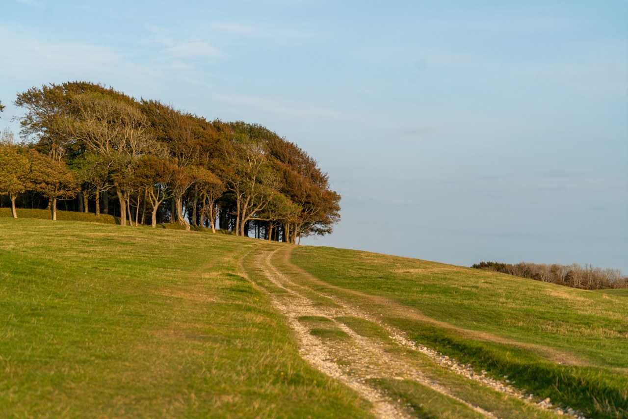
Camping accommodation
Why camp along the South Downs Way? A long-distance hike and overnight camping en route gives you the chance to enjoy the spectacular downland scenery at a leisurely pace – and this is made even more special as the South Downs National Park is a designated 'dark skies park', so you can camp under glittering stars on clear nights.
As this is an extremely popular hiking route, the best sites soon get booked up. Make your reservations early, especially in summer, so you’re guaranteed a pitch at your preferred site. Camping also makes it easy totakeyour dog along for the trip, as long as you book a dog-friendly campsite.
If you don’t want to carry camping gear, you can book baggage companies to move your equipment from site to site each day, especially useful if you’re hiking with family or friends and have a lot of kit to transport.
To see all the camping choices available to you on the South Downs Way, click the link under each day’s itinerary. There are plenty of official campsites covering all budgets and requirements.
South Downs Way Route
What can I see along the South Downs Way?
There are plenty of attractions – from amazing views to an ancient cathedral – on the South Downs Way. Here are five attractions you can see during your walk.
Winchester Cathedral
Burial place of King Arthur and Jane Austen, the cathedral was built in the Middle Ages in striking Gothic style. It is open for tours of its magnificent interior, its stained-glass windows and the 'Kings and Scribes: The Birth of a Nation' exhibition, depicting 1,000 years of English history. 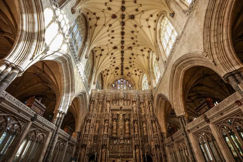
Bignor Roman Villa
This sprawling Roman-era mansion is built around a courtyard, and was discovered in 1811 when a farmer was ploughing his land. It is open (in summer only) for visitors to see the intricate patterns on the well-preserved mosaic floors, the underground heating system and the bathhouse.
Chanctonbury Ring
Chanctonbury Ring is thought to be around 2,000 years old. It was abandoned for centuries until the Roman invaders built a temple on the site. A ring of beech trees was planted atop the site in 1760, and it is one of the best-loved landmarks along the South Downs Way.
Lewes
This historic market town – with a priory, castle and the half-timbered former house of Anne of Cleves to explore – makes a pleasant day 'off' from walking the South Downs Way. If you don’t have time to stop for the day, you can relax in one of its restaurants or pubs after a long day’s hike.
Beachy Head
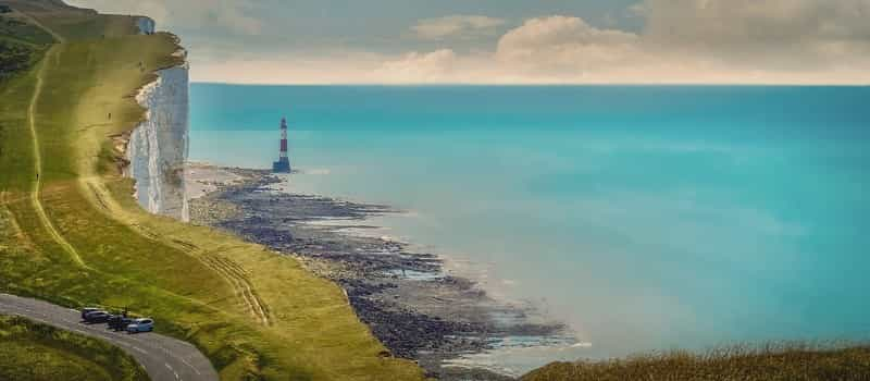
These magnificent white-chalk cliffs are the tallest in England, rising to 530 feet and offering spectacular views of the English Channel and the famous red-and-white striped lighthouse, which you can reach at low tide. There are pubs and cafés close by too.
An itinerary for the South Downs Way
Here is a guide to what you can expect to achieve daily – and what you can see – when walking along the South Downs Way. Each day’s walk ends near a village with a range of camping accommodation, as well pubs and shops on offer. We have written up the itinerary travelling from west to east, but there is no reason why you can’t simply reverse the route.
Break your journey to Winchester and camp overnight close to the South Downs Way. There’s a choice of quiet sites, many with pretty views over the South Downs, and staying locally means you can stock up at the city’s supermarkets before starting the walk.
See all our campsites near Winchester
Day One – Winchester to Exton (12 miles)
The starting point of the South Downs Way is in historic Winchester, seat of early medieval kings. The first leg leads hikers past Winchester Cathedral and out of the city suburbs. You’ll pass the MoD’s Chilcomb Range (watch out for red flags indicating that firing is taking place) and walk through the pretty hamlet of Chilcomb before embarking on the first of many climbs. This one leads up Cheesefoot Head, with views of the Solent.
The second major climb is in the Beacon Hill National Nature Reserve and gives fabulous views of the Meon Valley. The trail then descends to the charming flint-built village of Exton, which has plenty of camping options with glorious views over the chalk downs as well as inviting pubs.
Day Two – Exton to Buriton (13 miles)
Leaving Exton, there’s a slow climb up to Old Winchester Hill, where there’s an Iron Age hill fort to explore. The second incline of the day leads up Salt Hill, and then you’re on to Butser Hill, the highest point along the South Downs Way, and one with magical downland views.
The trail then leads through Queen Elizabeth Country Park, where you can catch your breath at the visitor centre and café. The next stop is close by in Buriton, where you can rest weary legs in the pubs and stock up at the local shop. You’ve also got a choice of rural glampsites and others with more of a wild-camping vibe.
Day Three – Buriton to Cocking (12 miles)
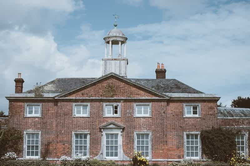
From Buriton, the trail follows the chalk escarpment, offering views over the Weald of Sussex and the English Channel. Today you’ll pass the National Trust-owned Uppark House with its hilltop folly, and head on to Harting Down, a series of remote chalk valleys.
You can either climb up Beacon Hill for more views or follow the South Downs Way around its base to the Bronze Age Devil’s Jump burial mounds and Andrew Goldsworthy’s 'Chalk Stone' sculpture trail, before dropping down to Cocking village, which has food and camping accommodation from glamping pods to simple sites with downland views.
Day Four – Cocking to Amberley (12 miles)
This leg of the South Downs Way is largely through woodland and farmland, wending slowly uphill into Charlton Forest, past more Bronze Age remains and on to Bignor Hill for views over the Arun Valley. You can branch off here to Bignor Roman Villa and its wonderfully preserved mosaic floors, at the bottom of the hill, before returning to the trail.
At the halfway point of the South Downs Way, the village of Amberley has cafés and pubs as well as a railway station if you’re not completing the whole walk. Here you have options for camping including glamping pods on farms and pitches at pubs. A little further away is Lagnersh Camping, with gorgeous downland views and spacious grass pitches.
Day Five – Amberley to Upper Beeding (13 miles)
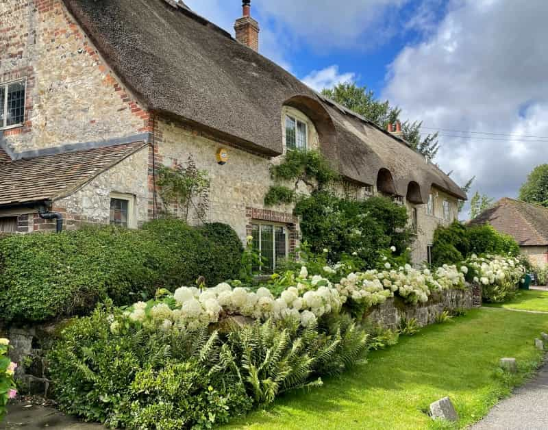
If you have time, stop off for a look around Amberley’s open-air museum, which traces the area’s industrial heritage. Once out of the village, near Washington village and its flint-built church, cross the busy A24 and head for Chanctonbury Ring, a prehistoric Iron Age fort, once a Roman religious site and now surrounded by a ring of beech trees.
Onwards from there, detour into Steyning if you need to stock up on supplies. Otherwise continue along the open path until you see the working chalk quarry at Upper Beeding. At the River Adur, head into Bramber, a pretty village with essential amenities as well as the Norman remains of Bramber Castle.
Your final stop for this stage is Upper Beeding, just over the bridge from Bramber, which has a convenience store and a couple of pubs. Shepherd’s huts, posh glamping pods and 'wild' camping on an official site are all overnight options here.
Day Six – Upper Beeding to Kingston (14 miles)
The dry chalk valley of Devil’s Dyke is the first major attraction on leaving Upper Beeding, with remnants of Stone Age settlement here and an Iron Age hill fort.
Second up on today’s agenda are the Jack and Jill Windmills – the latter is a working mill open on Sundays during the summer. This high-level open pathway also delivers awe-inspiring downland views. It ascends again to Ditchling Beacon, the highest point on the Sussex Downs, and then heads over the A27 and into Kingston, an overnight stop with pubs and shops.
Kingston is also very near Lewes, if you fancy some more dining options – or even taking a day off walking in order to explore the town properly.
Among secluded camping choices with South Downs views, Stud Farm campsite near Lewes has a relaxed, wild-camping vibe with the bonus of a farm shop selling meat for your evening barbecue, or there are plenty of luxury touches in the eco-friendly glamping pods at Brighton Experience Freedom Glamping.
Other campsites near Kingston and Lewes
Day Seven – Kingston to Alfriston (12 miles)
This section of the South Downs Way follows the chalk escarpment for some way; the walking is relatively flat in places and takes in the village of Southease in the Ouse Valley, where it’s worth having a look around the 12th-century Church of St Peter, which has an unusual round spire.
From there, it's on through grassy meadows before climbing up to Firle Beacon and then a slow descent into Alfriston, a half-timbered village with a slew of camping options – from glamping pods to simple wildlife havens – plus restaurants and pubs, as well as a bakery and convenience store.
View all campsites near Alfriston
Day Eight – Alfriston to Eastbourne (12 miles)
The final day of the walk kicks off by following the course of the Cuckmere River to the coast, and passing through Friston Forest into Seven Sisters Country Park. After that, there’s a lot of uphill and downhill walking along spectacular clifftops. The Seven Sisters cliffs are on the busiest part of the walk, with day hikers heading into Eastbourne from the car parks and visitor centre.
By the time you hit Beachy Head and its distinctive lighthouse, Eastbourne is in view, and the final destination is along the seafront promenade, where you can reward yourself with a pint in one of many pubs. Stay overnight at one of the local campsites to extend your trip by visiting the ancient Long Man of Wilmington, a chalk figure carved into the hillside, or meeting the meerkats at Drusillas Park.
Planning for the South Downs Way
Check out our camping packing lists and safety tips.
What to pack
Here’s a list of what to pack for a camping holiday, and a list of gear to carry when backpacking.

Can I walk the trail in winter?
Yes. Many campsites stay open over winter, but you’ll have shorter days, changeable weather and please bear in mind a chalk trail that can be very slippery after rain or snow.
Staying safe on the hike
The South Downs Way is a relatively challenging hike, so you need to know what to do if things go wrong..
-
Make sure someone knows where you are at all times, so they can raise the alarm if you don’t appear at your campsite at the appointed time.
-
Carry enough water for the day.
-
Dress for changeable weather, with plenty of layers topped by a waterproof.
-
Have a basic knowledge of first aid.
-
If there is an emergency, contact 999 or 112 and use the app what3words so they can easily locate you.
South Downs Way camping FAQs
Is wild camping allowed on the route?
Please note that it is largely illegal to wild camp in England, and there are plenty of designated campsites along the South Downs Way.
However, some farmers, landowners and pubs may allow you to camp on their land if you ask their permission first (some may charge a small fee).
A few rules to bear in mind if you do find yourself wild camping: remember not to camp close to people’s homes, in fields with crops or livestock, or near the trail; don’t light a campfire; and alway take your rubbish away with you.
How long is the South Downs Way?
The South Downs Way is 100 miles long, running from Winchester to Eastbourne. It is an undulating – steep in places – trail across chalk downs, with spectacular clifftop views over the English Channel. Aim to take around eight days to complete the route.
Is the South Downs Way suitable for kids?
There are lots of ups and downs along this route as it follows the chalk escarpment through the South Downs National Park. People walking with kids often choose to break the hike into sections, camping at family-friendly sites and walking for a couple of days at a time.
Which way should I walk the South Downs Way?
There is no 'right' way to hike the trail; you can start at either end, in Winchester to the west or Eastbourne in the east.
How do I get to the start of the South Downs Way?
Good train, bus and road services connect with both Winchester and Eastbourne. If you have brought your car, there are long-term car parks in both Winchester and Eastbourne where you can park securely while you complete the walk.
Where can I stock up for the walk?
It’s easy to pick up essentials, with major supermarkets in towns including Winchester, Petersfield, Lewes, Brighton and Eastbourne. You’ll also find plenty of shops, pubs and cafés in pretty villages along the way.