Mourne Camping
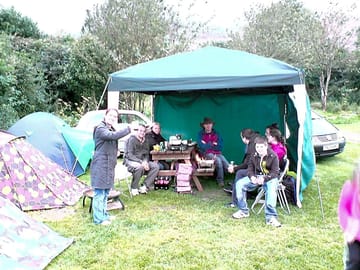
This campground does not currently take bookings here on Pitchup.com.
If you are the owner of this park, start taking bookings through Pitchup.com.
It's free, quick and easy!
 Add your business details
No information has been provided by the owner.
Campground owner? - add information in the Manager Portal to describe how wonderful your campground is.
Nearby parks that are bookable on Pitchup.com
Unfortunately, we have no nearby bookable campgrounds.
Features
 No dogs allowed
 Campfires allowed
Leisure on park
Bar or club house Cycle hire Evening entertainment Fishing Fitness centre Indoor swimming pool Kids' club On-site restaurant/cafe Outdoor swimming pool Playground Recreation room/arcade TV room Takeout Tennis WatersportsAmenities on park
Bath available Composting toilet Dog park Drying room Free wifi Grocery store Ice pack freezing Internet access Laundromat Parent & baby washroom Payphone Pick-up from public transport Portable toilet Pub toilets Restrooms Shower available Washing-up area WifiGroups welcome
Family friendly Motorcycle friendly Single-sex groups welcome Student groups welcomeRules
Barbecue grills allowed Barbecue provided Campfires allowed Commercial vehicles allowed Dogs allowed No dogs allowedUtilities
Charging facilities Dump station Electric car charging point(s) Propane/gas cylinders available Recycling available Renewable energyNearby amenities
Bar nearby Convenience store nearby Dog walk nearby Public transportation nearbyNearby leisure
Fishing nearby Restaurant nearbyLocation
Mourne Camping
Bloody Bridge
Mourne
Newcastle
Co. Down
Northern Ireland
BT33 0LA
 Directions
 Timezone
Europe/London +0100 (GMT+01:00)
GPS
54.176°N
5.8782°W
Please note: All distances on this page are calculated "as the crow flies" - please check actual distance depending on your mode of travel using the Get directions button above.
Local attractions
Food and drink
- Harbour House Pub 1.6 mi
- N. Macken Pub 1.6 mi
- O'Hare's Pub 2.2 mi
- Hugh McCann's Cafe/Bar Pub 2.2 mi
- Pacha Restaurant 2.2 mi
- The Anchor Bar Pub 2.2 mi
- The Mariner Restaurant 2.3 mi
- Balti House Restaurant 2.4 mi
- Salis Restaurant 2.4 mi
- Piccolo Kitchen Restaurant 2.5 mi
Groceries
- Lidl Supermarket 2.3 mi
- Quinn's Off-licence 2.5 mi
- Eurospar Supermarket 3 mi
- Centra Supermarket 3.1 mi
- Tesco Supermarket 3.2 mi
- Bin 34 Off-licence 6.2 mi
Parks and play
- Donard Park 2.2 mi
- Castle Park 2.5 mi
- Castle Park Play Area Playground 2.5 mi
- Downs Road Play Park Playground 2.6 mi
- Islands Park 2.6 mi
- Islands Park Play Area Playground 2.7 mi
- Back Field Play Park Playground 3.1 mi
- Tollymore Forest park 4 mi
- Tollymore Forest Park 4 mi
- Tollymore Forest Park Play Park Playground 4.2 mi
Family days out
- Slieve Donard Visitor attraction 1.8 mi
- Kent Amusements Amusement arcade 2.3 mi
- Arcadia Amusements Amusement arcade 2.3 mi
- Joyland Amusement arcade 2.4 mi
- Fun Land Amusement arcade 2.5 mi
- The Starks Find Direwolf Pups Visitor attraction 4.2 mi
- The Wildling Pit Visitor attraction 4.5 mi
- Dundrum Castle 6.1 mi
- Ice House Castle 6.8 mi
- Castlewellan Castle 6.9 mi
- Tea House Castle 7.1 mi
- Moorish Tower Castle 7.4 mi
- Clough Castle 8.2 mi
- Castle Screen 9.3 mi
Public transport
- Bloody Bridge 0.2 mi
- 80-87 Ballagh Road 0.3 mi
- 101–103 Ballagh Road 0.5 mi
- Maggie's Leap 0.5 mi
- 117-121 Ballagh Road 0.7 mi
- Blue Quarry 0.9 mi
- 135-141 Ballagh Road 1.1 mi
- Widow's Row 1.4 mi
- Coastguard Station 1.4 mi
- Dunmore Hill 1.5 mi
What’s nearby
- Newcastle Yacht Club Marina 1.5 mi
- Royal County Down Golf Course 3.2 mi
Local services
- ecar Charge Point Charging station 2.2 mi
- Thornton's Pharmacy 2.3 mi
- Causeway Surgery Doctors 2.4 mi
- Easygo Charging station 2.4 mi
- Causeway Surgery Doctors 2.4 mi
- Dromara & Drumgooland CreditUnion Ltd Cashpoint 2.5 mi
- Superdrug Pharmacy 2.6 mi
- Gordons Chemist Pharmacy 2.7 mi
- McKeever's Pharmacy 2.7 mi
- ecar Charge Point Charging station 2.7 mi
Must see
Castle Ward 17.4 mi
Grand Opera House 28.7 mi
Harland And Wolff Shipyard 29.1 mi
Belfast City Hall 29.1 mi
National Trust
Castle Ward 18.1 mi
Rowallane Garden 18.9 mi
Derrymore House 20.2 mi
Mount Stewart House, Garden and Temple of the Winds 28.7 mi
The Crown Bar 29 mi
Cycle routes
Find local routes on the National Cycle Network - over 12,000 miles of cycling routes.
Other
CARLINGFORD LOUGH ISLANDS (CURRENT BOUNDARY FROM 15/02/1996) 13.5 mi
STRANGFORD BAY & SANDY ISLAND (CURRENT BOUNDARY FROM 09/09/1994) 18.5 mi
Please note: All distances on this page are calculated "as the crow flies" - please check actual distance depending on your mode of travel using the Get directions button above.
Reviews
No reviews yet.
Frequently asked questions
- Does Mourne Camping have a swimming pool? No View all features
- Is Mourne Camping dog friendly? No View all features