Best Snowdonia (Eryri) Hikes
Lace up your boots and prepare for adventure in Eryri, also known as Snowdonia National Park. This wild ares of North Wales boasts over 800 square miles of mountainous terrain, including Snowdon, the highest peak in Wales. There's somethng here for hikers of all abilities, from low-level strolls to challenging scrambles up knife-edge ridges. This page covers some of Snowdonia's most iconic hikes as well as Eryri's less-travelled trails to help you plan for your next trip to the mountainous heart of Wales.
Book a Snowdonia glamping break
High peaks adventures
Big mountains, deep valleys and peaceful lakes are what Snowdonia is best known for. Here are some of the best mountain walks in the area.
Cadair Idris via the Minffordd Path
Located in the south of the national park, Cadair (or Cader) Idris is a hill steeped in Welsh myth and folklore. The Minffordd Path is a strenuous climb, but the views along the way and at the top are more than worth it. The path winds through valleys, rising above a peaceful river. Eventually, you'll reach a ridge where you can stop and admire the mountainous landscape and appreciate the contrast between the green fields lower down and the rocky peaks above. The trail gets narrower towards the top, but the path is clearly defined and fairly straightforward. If you want to extend this stunning six-mile hike, make a detour on the way up or down to Llyn Cau, a small lake in the shadow of the summit.
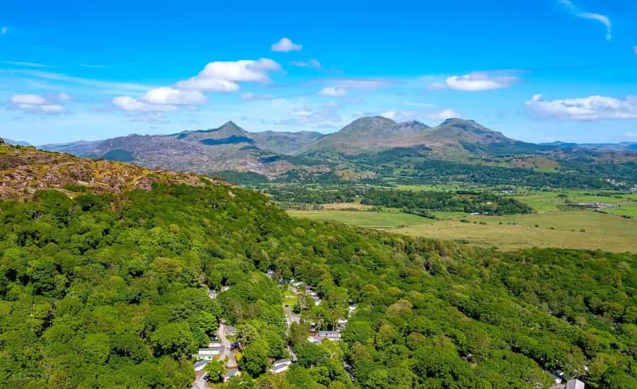
The Rhinogs
A trek through the remote Rhinogs offers a taste of wild Wales. The classic route, the Rhinog Fawr and Rhinog Fach circular, is an 8-mile adventure in a quieter part of the national park, with panoramic views over all of southern Snowdonia. The initial leg winds through Cwrt Forest, following the Nant Llyn-du stream. After tackling some steeper sections, you'll be rewarded with views of Llyn Hywel, a small mountain lake.
The ascent to Rhinog Fach itself involves some scrambling, and the path sometimes disappears among the rocks. Highlights include the dramatic summits of both Rhinog Fawr and Rhinog Fach, both with unforgettable vistas. Keep your eyes peeled for red grouse and grazing sheep along the way. Remember, this is wild country, and help (if you need it) could be far away, so proper hiking gear, navigation skills, and checking weather conditions are crucial to planning a successful trip.
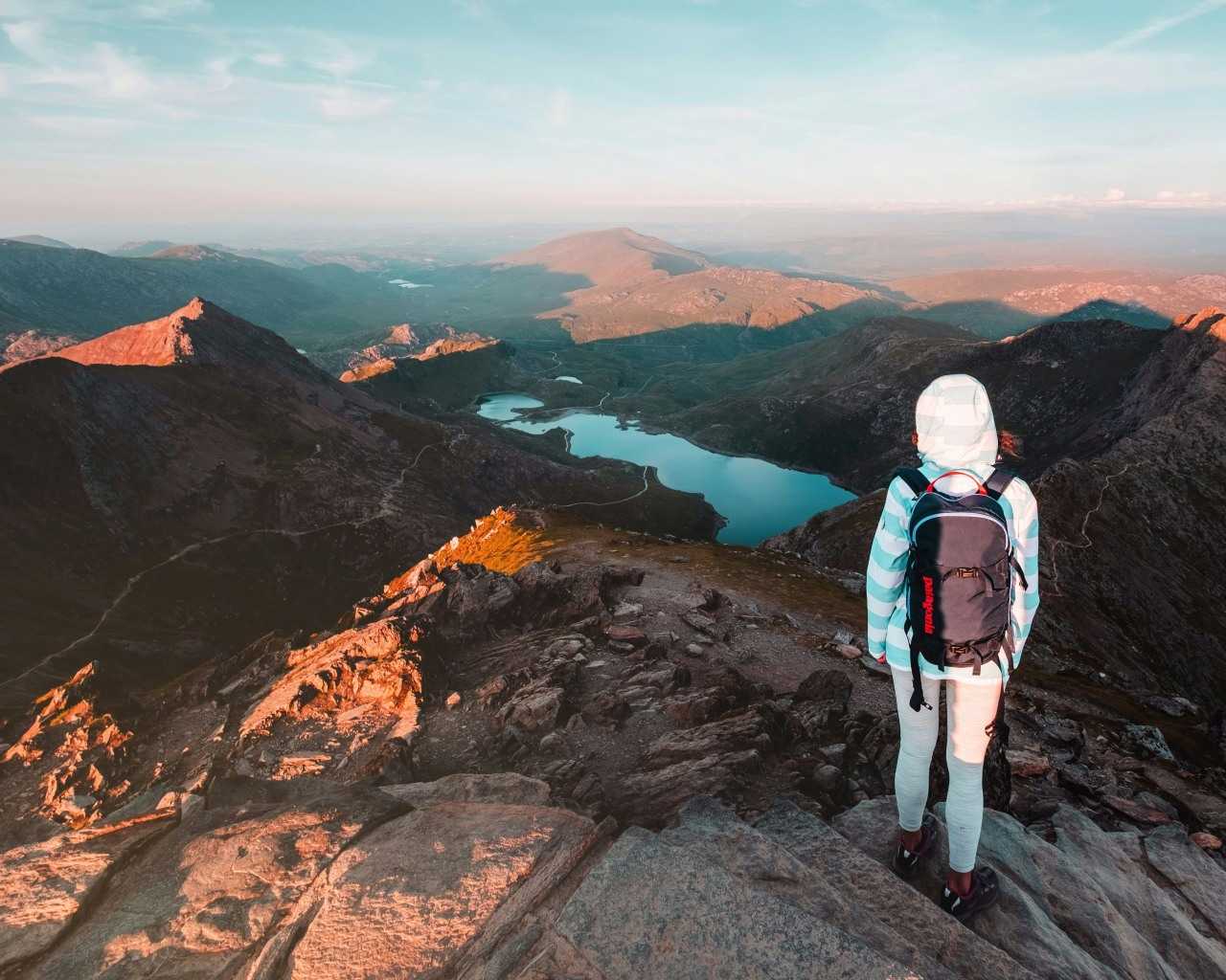
Mount Snowdon hikes
Next, let’s take a look at two of the several routes up Snowdon. Known as Yr Wyddfa in Welsh, at over 1000 metres it’s the tallest British mountain outside of the Scottish Highlands. Parking at the start point, Pen-y-Pass, is often very difficult because of the popularity of these hiking routes (booking in advance is highly recommended to guarantee a space), but frequent local buses run between the car park and nearby towns like Llanberis and Betws-y-Coed.
Snowdon via the Pyg Track and Miners’ Track
This popular route starts at Pen-y-Pass and is a fantastic way to climb Snowdon. The route isn’t too technically difficult (although some sections are steeper and rougher than others), and both paths run broadly parallel to each other, meaning you can climb up via one and descend via the other for added variety. All in all, you should be able to walk this seven-mile route in five or six hours in reasonable weather conditions. The ascent is well worth it, as there are stunning views of the Snowdon Lakes and ridges like Crib Goch to admire along the way.
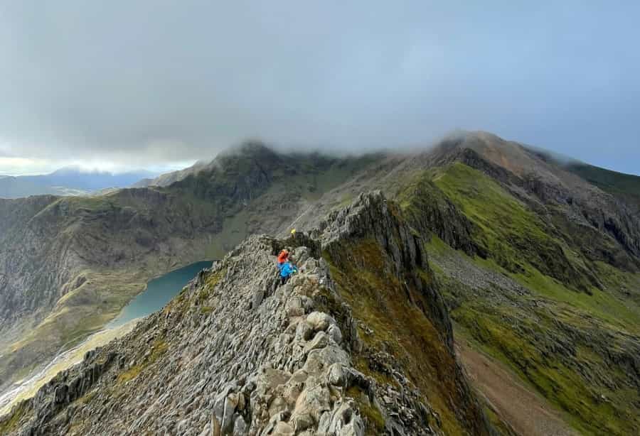
Snowdon via Crib Goch
Crib Goch is a thrilling but risky route to Snowdon's peak that should only be attempted by confident hikers with good scrambling skills. Part of the so-called Snowdon Horseshoe, this knife-edge ridge is just to the north of the Snowdon lakes and summit, so you can expect fantastic views – although for much of the route, you'll want to be concentrating on the section directly ahead of you. Although marked as a path on many maps, the Crib Goch route is extremely rough and exposed – this can be exhilarating, but it can also be dangerous.
If you have no experience of this kind of route and want to learn the kind of skills you need to attempt it, seek out instruction at one of Snowdonia’s many outdoor education centres, such as Plas y Brenin in Capel Curig.
More straightforward routes up Snowdon can be taken, including the classic Llanberis Path (which follows the railway to the summit), the Watkin Path, the Rhyd Ddu Path, and the Snowdon Ranger Path (a Pitchup favourite for a quick ascent).
Book a Snowdonia glamping break
Rugged ridge walks
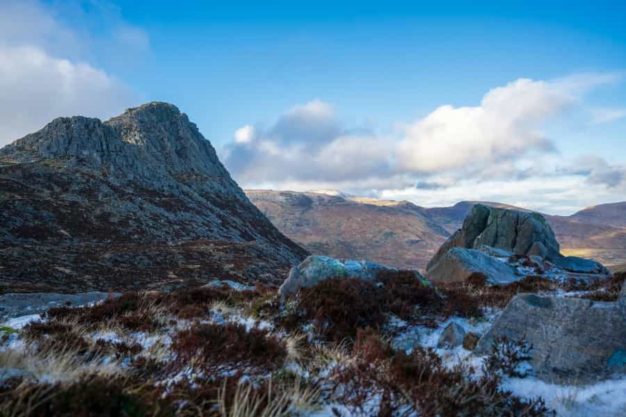
Eryri has many ridge walks to discover. Remember, these are not walks for beginners and should be carefully researched before setting out. Some of the most popular are listed below.
-
Tryfan is an imposing mountain that towers above Llyn Ogwen, a pretty lake just off the A5. There are various routes to the top, but all involve an element of scrambling (i.e., you’ll have to use your hands as well as your feet to get to the summit). Whether you opt for the exposed and challenging North Ridge or the easier but still adventurous Heather Terrace route, good navigation skills are required, as this complex mountain has lots of gullies that can be easily confused.
-
Another exciting ridge walk takes you between Glyder Fawr and Glyder Fach. It’s possible to do this route as an extension of Tryfan, carrying on south after completing the North Ridge, but it’s also possible to do as a circular walk from the Llyn Ogwen car park. As well as Llyn Ogwen, this route passes three other mountain lakes, making it a very scenic hike. The ridge that connects the two mountain peaks is challenging, with steep sections and loose rocks, but the views are spectacular.
Caught the scrambling bug? Find more scrambling and rock climbing adventures with our guide to climbing in Snowdonia.
The Snowdonia Way – a long-distance challenge
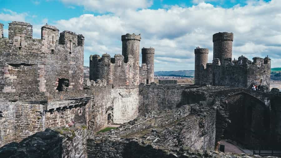
While most visitors coming to Eryri will want hikes that can be completed within a day, the area also has some stunning long-distance routes that offer a different but highly rewarding experience. The most ambitious of these is the Snowdonia Way, a 97-mile waymarked trail that stretches the entire length of the national park between Conwy in the north and Machynlleth in the south.
The low-level route winds through forests, small villages and peaceful farming landscapes, with fantastic views over the high peaks and historic highlights including castles, mines and old Roman roads. There’s also a longer high-level route that includes many of Snowdonia’s most iconic climbs – but as the two routes often intersect, you can easily explore both at your own pace. For more information and route maps, check out the Long Distance Walkers Association’s website.
For inspiration on shorter and easier walks, check out the Pitchup guide to Snowdonia’s best walking routes.
With multi-day treks, exhilarating mountain climbs and rugged ridge walks, there’s no wonder Snowdonia is widely seen as a haven for hikers.
Book a Snowdonia glamping break
Wondering which map you’ll need to begin your adventure? Use the Ordnance Survey map selector tool to make sure all your chosen hikes are covered. Looking to research your routes in more detail before you go? The national park’s official website is a good place to start.
Wherever you’re planning on staying in Snowdonia, Pitchup has a wide selection of outdoor accommodation to choose from.