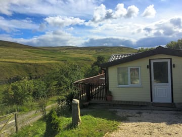
Low Bollihope Farm


Detta ställe tar för tillfället inte emot bokningar här på Pitchup.com.
Om du är det här ställets ägare kan du börja ta emot bokningar via Pitchup.com.
Det är gratis, snabbt och enkelt!
Typ av ställe
Talade språk
Engelska
Närliggande ställen som kan bokas via Pitchup.com
Det finns tyvärr inga bokningsbara ställen i närheten.
Vill du veta mer om camping i Co. Durham?
Egenskaper
Hundar inte tillåtna
Aktiviteter på platsen
Bar eller klubbhus Barnklubb Cykeluthyrning Fiske Fitnesscenter Inomhusbad Kvällsunderhållning Lekplats Restaurang/cafe på stället Spelrum Takeaway Tennis Tv-rum Utomhuspool VattensportBekvämligheter på platsen
Badkar tillgängligt Bilparkering vid boendet/enheten Bärbar toalett Diskutrymme Dusch tillgänglig Familjetoaletter Gratis WiFi Hundrastgård Hämtning från kollektivtrafik Internetanslutning Komposttoalett Kylning av kylklampar Matbutik Offentlig telefon Toalettblock Toaletter på puben Torkrum Tvättomat WiFiGrupper är välkomna
Familjevänligt Grupper av samma kön är välkomna Lämpligt för motorcyklar Studentgrupper är välkomnaRegler
Grillning tillåts Hundar inte tillåtna Hundar tillåtna Kommersiella fordon tillåts Lägereldar tillåtna Tillgång till grillTeman
Avlägsen plats Lugn Naturparadis Paradis för vandrare Skog Spektakulära landskapTjänster
Förnybar energi Gasflaskor tillgängliga Laddningsmöjligheter Laddstationer för elbilar Tömning av kemiskt avfall Återvinning tillgängligBekvämligheter i närheten
Bar i närheten Butik i närheten Hundvänligt område i närheten Jordbruksmarknad i närheten Kollektivtrafik i närhetenTyp
Bondgård Mini (1–10 platser)Tillgänglighet
Handikappanpassade anläggningarAktiviteter i närheten
Bergscykling i närheten Cykeluthyrning i närheten Cykling i närheten Hästridning i närheten Kanot/kajak i närheten Klättring i närheten Restaurang i närheten Utomhuspool i närhetenLäge
Low Bollihope Farm
Low Bollihope
Frosterley
Co. Durham
England
DL13 2SY
Tidszon
Europe/London GMT (GMT+00:00)
GPS
54,71239° N
−1,97728° W
Vägbeskrivning
Närmaste transport
Observera: Alla avstånd på den här sidan mäts fågelvägen – kontrollera det egentliga avståndet beroende på hur du reser genom att använda knappen 'Få vägbeskrivning' ovan.
Lokala sevärdheter
Vattenkvalitet i närliggande badvatten
| Namn | Avstånd | Typ | 2020 | 2019 | 2018 | 2017 |
|---|---|---|---|---|---|---|
| Seaham Hall Beach | 43,6 km | Hav | N/A | Bra | Bra | Utmärkt |
| Seaham Beach | 43,7 km | Hav | N/A | Bra | Utmärkt | Utmärkt |
| Roker - Sunderland | 45,8 km | Hav | N/A | Utmärkt | Utmärkt | Utmärkt |
| Seaburn - Sunderland | 46,5 km | Hav | N/A | Utmärkt | Utmärkt | Utmärkt |
| Crimdon | 46,8 km | Hav | Bra | Utmärkt | Utmärkt | Utmärkt |
Informationskälla: Europeiska miljöbyrån
Måste ses
High Force Waterfall 15 km
Barnard Castle 17,8 km
The Bowes Museum 19,3 km
Locomotion:The National Railway Museum at Shildon 23,6 km
Durham Cathedral 26,6 km
National Trust
Gibside 27,9 km
Cherryburn 28 km
Allen Banks and Staward Gorge 36,2 km
Washington Old Hall 36,2 km
Holy Jesus Hospital 37,2 km
Cykelleder
Hitta lokala leder på National Cycle Network – över 19 000 km cykelleder.
Annat
Stanhope - Stanhope Dene - Stanhope Burn Mine 4,3 km
Stanhope - Crookledy Crag - Stanhope 4,4 km
Circular Walk by Wolsingham 6 km
Wolsingham and Tunstall Reservoir 6,4 km
Tunstall Reservoir 7,7 km
Observera: Alla avstånd på den här sidan mäts fågelvägen – kontrollera det egentliga avståndet beroende på hur du reser genom att använda knappen 'Få vägbeskrivning' ovan.
Erbjudanden
Villkor gäller – för mer information, se sektionen för boendetyp
Recensioner
Inga recensioner ännu.
Vanliga frågor
- Finns det pool på Low Bollihope Farm? Nej Visa alla egenskaper
- Är Low Bollihope Farm hundvänligt? Nej Visa alla egenskaper
- Vad finns det för sevärdheter i närheten av Low Bollihope Farm? Along its 77-mile length, the Weardale Way roughly follows the course of the River Wear, taking in woods, farmland, moors and villages as it meanders. To make it a bit more manageable … Läs mera
- När kan jag checka in på och checka ut från Low Bollihope Farm?
Läs meraLogi på stället Ankomst: 14:00 – När som helst Avfärd senast: 11:30