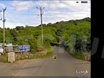
Melin Rhos Caravan Park


This campground does not currently take bookings here on Pitchup.com.
If you are the owner of this campground, start taking bookings through Pitchup.com.
It's free, quick and easy!
Campground type
Tourist board rating
Languages spoken
English
This site is a member of Bodafon Group group.
Nearby campgrounds that are bookable on Pitchup.com
Unfortunately, we have no nearby bookable campgrounds.
Want to know more about camping in Anglesey?
Features
Dogs allowed
Leisure on site
Bar or club house Cycle hire Evening entertainment Fishing Fitness centre Games room Indoor swimming pool Kids' club On-site restaurant/cafe Outdoor swimming pool Play area TV room Take away Tennis WatersportsAmenities on site
Bath available Car parking by site/unit Composting toilet Dog park Drying room Food shop Free wifi Ice pack freezing Internet access Laundry Parent & baby washroom Pick-up from public transport Portable toilet Pub toilets Public telephone Shower available Toilet block Washing-up area WifiGroups welcome
Family friendly Motorcycle friendly Single-sex groups welcome Student groups welcomeRules
Barbecue provided Barbecues allowed Campfires allowed Commercial vehicles allowed Dogs allowedUtilities
Charging facilities Dump point Electric car charging point(s) Gas cylinders available Recycling available Renewable energyNearby amenities
Bar nearby Dog walk nearbyAccessibility
Disabled facilitiesNearby leisure
Fishing nearby Golf nearby Horse riding nearby Sailing nearbyTouring and motorhomes
Caravan storage facilitiesLocation
Melin Rhos Caravan Park
Lligwy Bay
Moelfre
Anglesey
Wales
LL70 9HQ
Timezone
Europe/London +0100 (GMT+01:00)
GPS
53.3538°N
-4.2702°W
Route directions
Nearest transport
Please note: All distances on this page are calculated "as the crow flies" - please check actual distance depending on your mode of travel using the Get directions button above.
Local attractions
Water quality at nearby bathing waters
| Name | Distance | Type | 2020 | 2019 | 2018 | 2017 |
|---|---|---|---|---|---|---|
| Traeth Lligwy | 1.4 km | Sea | Excellent | Excellent | Excellent | Excellent |
| Benllech | 5.4 km | Sea | Excellent | Excellent | Excellent | Excellent |
| St Davids - Benllech | 6 km | Sea | Excellent | Excellent | Excellent | Excellent |
| Llanddona | 9.2 km | Sea | Excellent | Excellent | Excellent | Excellent |
| Cemaes | 13.6 km | Sea | Good | N/A | N/A | Poor |
Data source: European Environment Agency
Must see
Beaumaris Castle 15.5 km
Penrhyn Castle 22 km
Caernarfon Castle 23.8 km
Snowdon Mountain Railway 27.9 km
National Slate Museum 27.9 km
National Trust
Plas Newydd Country House and Gardens 17.1 km
Aberconwy House 30.5 km
Bodnant Garden 34 km
Ty^ Mawr Wybrnant 44 km
Cycle routes
Find local routes on the National Cycle Network - over 12,000 miles of cycling routes.
Other
Wern y Wylan - Pentraeth Forest - Wern y Wylan 8.9 km
MALLTRAETH MARSH (CURRENT BOUNDARY FROM 05/07/2002) 15.2 km
Penmon Priory - Penmon Point - Penmon Priory 15.2 km
Porth Swtan to Ynys y Fydlyn and Mynydd y Garn 19 km
VALLEY WETLANDS (CURRENT BOUNDARY FROM 17/09/2004) 19.2 km
Please note: All distances on this page are calculated "as the crow flies" - please check actual distance depending on your mode of travel using the Get directions button above.
Reviews
No reviews yet.
Frequently asked questions
- Does Melin Rhos Caravan Park have a swimming pool? No View all features
- Is Melin Rhos Caravan Park dog friendly? Yes View all features