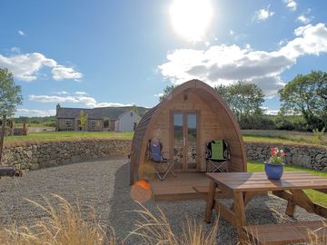
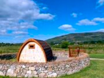
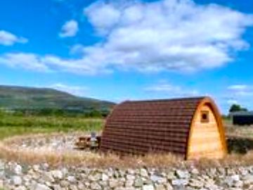
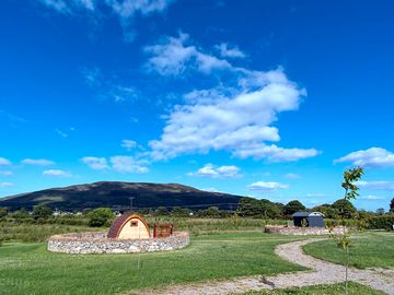
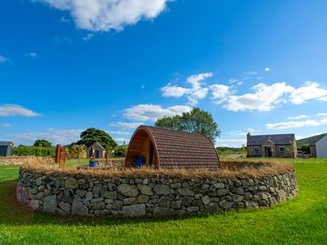
Bluebell Lane Glamping
Aquest càmping no accepta reserves de Pitchup.com en aquests moments.
Si sou propietari/a d'aquest allotjament, comenceu a rebre reserves a través de Pitchup.com.
És gratuït, ràpid i fàcil!
- Glàmping al sud d'Armagh amb vistes espectaculars a l'Anell de Gullion
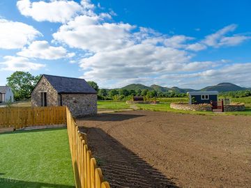
- En una Àrea de Bellesa Natural Excepcional
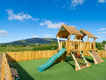
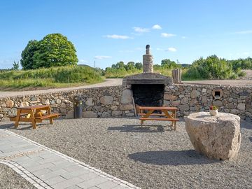
- Zona de jocs i es permet fer fogueres i barbacoes
Tipus d'allotjament
Idiomes parlats
![]() Anglès
Anglès
Càmpings a prop que es poden reservar a Pitchup.com
Malauradament no hi ha càmpings amb unitats disponibles per reservar a prop.
Característiques
![]() Gossos prohibits
Gossos prohibits
![]() Fogueres permeses
Fogueres permeses
Activitats d'oci al càmping
Bar o club Club/animació infantil Entreteniment nocturn Esports aquàtics Gimnàs Lloguer de bicicletes Menjar per emportar Parc infantil Pesca Piscina coberta Piscina exterior Restaurant/cafeteria in situ Sala de TV Sala de jocs TennisServeis i instal·lacions al càmping
Banyeres disponibles Banys per a famílies amb nadons Blocs sanitaris Botiga d'alimentació Bugaderia Cambra d'assecatge Congelador per a bosses tèrmiques de gel Connexió a internet Dutxes disponibles Fregador Lavabo ecològic Lavabo mòbil Lavabos compartits a pubs Lloguer de tendes de campanya Productes locals Recollida d'estacions de transport públic Telèfon públic Wifi Wifi gratuït Àrea per a gossosReserves de grups
Apte per a famílies Apte per a motociclistes Grups d'estudiants Grups unisexCondicions especials
Barbacoa proporcionada Barbacoes permeses Fogueres permeses Gossos permesos Gossos prohibits Vehicles comercials lleugers permesosTemàtica
Bosc Econòmic/turista de motxilla Llac i/o muntanya Paisatges espectaculars Paradís natural Paradís per a senderistes Sense serveis Tranquil Ubicació remotaServeis
Bombones de gas disponibles Eliminació de residus químics Energia renovable Punts de recàrrega per a cotxes elèctrics Punts per carregar aparells Reciclatge disponibleServeis a prop
Bar a prop Botiga d'alimentació a prop Transport públic a prop Àrea per passejar gossos a propTipus
Dins d'una granja Molt petit (1-10 parcel·les)Activitats d'oci a prop
Ciclisme a prop Equitació a prop Golf a prop Lloguer de bicicletes a prop Lloguer de piragües/caiacs a prop Pesca a propCaravanes i autocaravanes
Desguàs per a caravanes Presa d'aigua per a caravanes Àrea de servei per a autocaravanesUbicació
Bluebell Lane Glamping
49 Tullymacrieve rd
Mullaghbawn
Newry
Down
Irlanda del Nord
BT35 9RE
Zona horària
Europe/London +0100 (GMT+01:00)
GPS
54,12016° N
6,49422° O
Atenció: Totes les distàncies es calculen en línia recta. Comproveu la distància real en funció del mitjà de transport fent servir el botó "Com arribar" que hi ha a dalt.
Llocs d'interès
Qualitat de l'aigua a les zones de bany que hi ha a prop
| Nom | Distància | Tipus | 2020 | 2019 | 2018 | 2017 |
|---|---|---|---|---|---|---|
| Shelling Hill/Templetown | 27,4 km | Mar | Excel·lent | Excel·lent | Excel·lent | Excel·lent |
| Cranfield (Cranfield Bay) | 29,4 km | Mar | Excel·lent | Excel·lent | Excel·lent | Excel·lent |
| Port, Lurganboy | 36,1 km | Mar | Excel·lent | Excel·lent | Excel·lent | Excel·lent |
| Clogherhead | 40,9 km | Mar | Excel·lent | Excel·lent | Excel·lent | Excel·lent |
| Newcastle | 41 km | Mar | N/A | N/A | N/A | N/A |
Font de les dades: Agència Europea del Medi Ambient
National Trust
Derrymore House 10,5 km
Ardress House 36,7 km
The Argory 39,3 km
Rutes ciclistes
Trobeu rutes locals de la Xarxa Nacional de Bicicletes: més de 19.000 kilòmetres de rutes ciclistes.
Altres
CARLINGFORD LOUGH ISLANDS (CURRENT BOUNDARY FROM 15/02/1996) 28 km
Atenció: Totes les distàncies es calculen en línia recta. Comproveu la distància real en funció del mitjà de transport fent servir el botó "Com arribar" que hi ha a dalt.
Comentaris
Encara no hi ha cap comentari.
Preguntes més freqüents
- Hi ha piscina a Bluebell Lane Glamping? No Mostra totes les característiques
- S'admeten gossos a Bluebell Lane Glamping ? No Mostra totes les característiques
- Quins llocs d'interès hi ha a prop de Bluebell Lane Glamping? The famed Ring of Gullion, the first ring dike in the world to be geologically mapped, sits atop famed Slieve Gullion, the highest peak in County Armagh. Clamber up here if you … Llegeix més
- A quina hora puc registrar la meva entrada i sortida de Bluebell Lane Glamping?
Llegeix mésCàmping i autocaravanes Arribada: 15:00 – 21:00 Sortida abans de les: 10:30 Allotjament in situ Arribada: 15:00 – 21:00 Sortida abans de les: 10:30