The Best Walks in the Yorkshire Dales
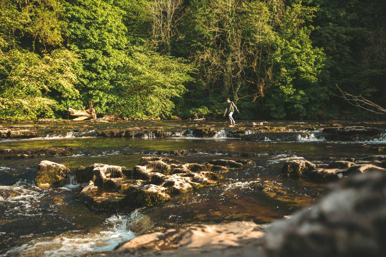
The beautiful Yorkshire Dales National Park is renowned for its dramatic moorland landscapes, rolling hills, tumbling rivers and pretty villages. There’s a huge choice of walking routes here that cater to all abilities, making it a perfect destination for families and casual walkers.
Our guide to the best walks in the Yorkshire Dales takes in waterfalls, historic sites, rock formations, caves and woodland, as well as one of the Dales’ highest peaks, with lots of useful information to help you plan your day out.
Best waterfall walks in the Yorkshire Dales
Aysgarth Falls
Start/end: Aysgarth Falls Visitor Centre
Distance: Various options available
The beauty of Aysgarth Falls is no secret. Tourists and walkers – including William Wordsworth and JMW Turner – have been visiting this idyllic site in Wensleydale for more than 200 years. Right next to a National Trust Visitor Centre and car park, the falls couldn’t be easier to access, and a trip here offers a choice of easy walks (including an accessible Miles Without Stiles option) on well-maintained paths through the Freeholders’ Wood nature reserve and past the three stepped waterfalls on the River Ure.
Whichever route you choose, you can look out for primroses and bluebells in spring, deer in the woodlands and leaping salmon in autumn, as well as admiring the Upper, Middle and Lower Falls themselves from convenient riverside viewing platforms.
Local tip: Visit after rainfall to get the most spectacular view of the cascades. If you’re thinking of taking a picnic, there are benches and riverside beaches above the Upper Falls. If not, the Mill Race Teashop, in an 18th-century mill by the Upper Falls, is a great place to stop for homemade cakes, sandwiches, snacks and simple lunches.
Ingleton Waterfalls Trail
Start/end: Ingleton
Distance: 4.3 miles (7km) loop
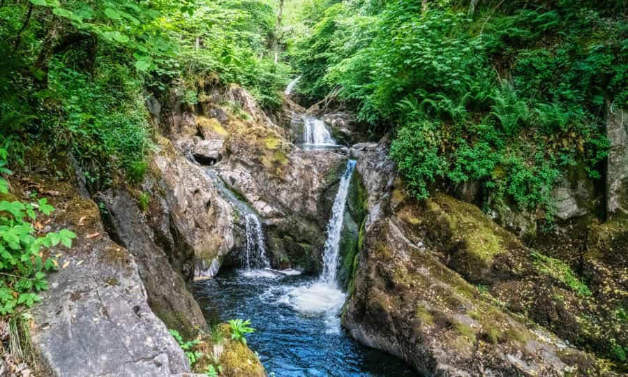
This lovely circular walk from the village of Ingleton takes in a series of waterfalls on the Twiss and Doe rivers and some beautiful oak woodlands, with great views over the surrounding countryside. It’s moderately strenuous, with lots of steps and some slippery sections, but there’s no doubt that it’s worth the effort, and you should be fine as long as you have sturdy footwear.
The footpaths are easy to follow and have excellent views of cascades including Thornton Force, Pecca Falls, Snow Falls and Hollybush Spout.
Full details of the walk (including a downloadable map), the history of the site and what to look out for on the way are available on the Ingleton Waterfalls website.
Local tip: The trail is open every day, and there's an entry fee that helps to maintain the paths. Dogs (on leads) are welcome.
Hawes and Hardraw Force
Start/end: National Park Visitor Centre, Hawes
Distance: 4.25 miles (7km) loop
This pleasant walk from the market town of Hawes includes a section of the Pennine Way, taking you along the River Ure and through the beautiful Wensleydale countryside to England’s highest single-drop waterfall, Hardraw Force. Signposted, largely flat and suitable for all ages and abilities, it takes in a pretty wooded gorge before you reach the waterfall, famous for its 30-metre drop. The waterfall itself is located on private land behind the Green Dragon Inn, and there is a small entrance fee.
A map, pictures and a detailed description of the route are available on the Dales Walks website. If you just want to see the falls, you can park at the pub and make the short walk from there.
Local tip: The falls are also famous as the location for the scene from Robin Hood: Prince of Thieves where Maid Marian spots Robin (Kevin Costner) bathing under the cascade. We can’t promise that you’ll see him though…
Scenic walks in the Yorkshire Dales
Malham Cove
Start/end: National Park Visitor Centre, Malham
Distance: 2 miles (3.2 km) out and back
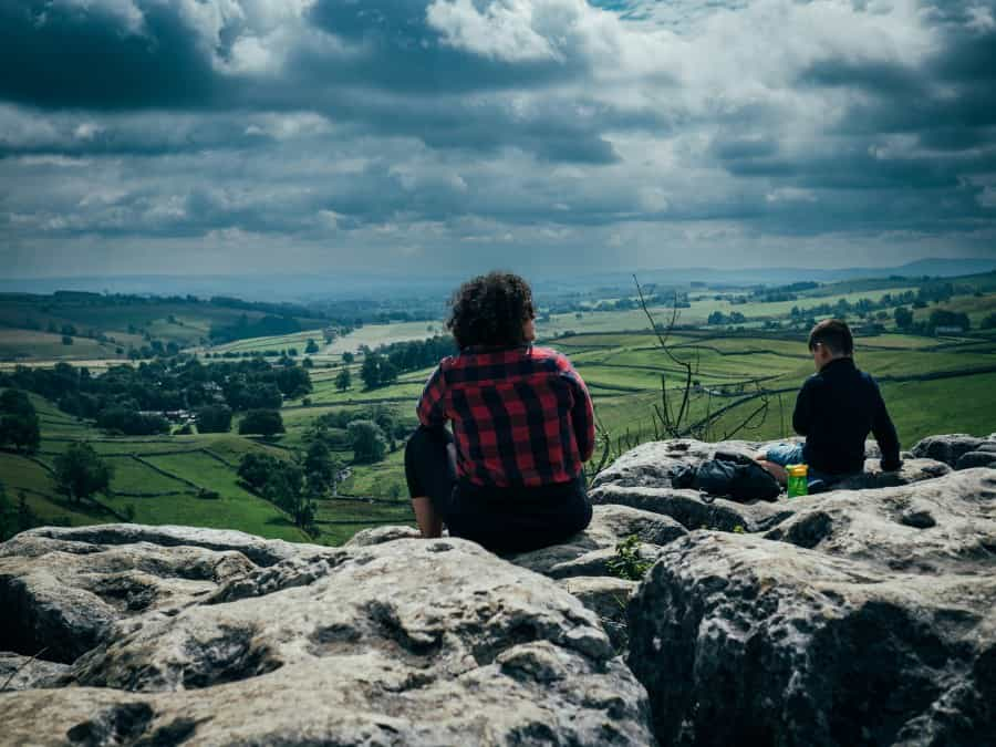
A 70-metre high curving limestone cliff that forms an impressive natural amphitheatre, Malham Cove was once the site of a towering glacial waterfall. Today it’s a popular attraction for walkers and climbers, and home to nesting birds including peregrine falcons and jackdaws.
This short walk from the national park’s visitor centre at Malham follows a woodland trail out of the village beside Malham Beck, and then takes a well-maintained path to the cliff. To experience the full majesty of the site, climb the 400 stone steps to the limestone pavement at the top. This requires more effort, of course, but you’ll be rewarded with fabulous panoramic views over the park.
If this whets your appetite, there are several other walking routes in the area, so you could extend your trip to take in the Janet’s Foss woodland waterfall, the hidden gorge at Gordale Scar and Malham Tarn lake, or try the 4.5-mile Landscape Trail that visits all four sites. The national park’s downloadable Malham Walks leaflet covers all these options.
Local tip: For walkers with limited mobility, the Lister Arms pub in Malham has a mobility scooter you can borrow that will enable you to visit the Cove and Gordale Scar. Details are available on the Access The Dales website, and we’d recommend booking in advance.
Grassington Meadows and Linton Falls
Start/end: National Park Visitor Centre, Grassington
Distance: 1 mile (1.6km) circular
This gentle Miles Without Stiles walk takes you from the park’s visitor centre in the pretty village of Grassington through the grassy meadows beside the River Wharfe to the beautiful Linton Falls, before following a short loop beside the river and then returning through the village. The path is well maintained and easy to follow, and if you want to go further, there are several options to extend it into the local countryside.
If you have children with you, they'll be delighted by the stepping stones downstream, which allow you to cross the river when conditions are suitable. If you’d like to explore a little more, you can also cross the river via a footbridge and wander down to Linton Church, or continue further through the meadows to the Grass Wood nature reserve before retracing your steps.
There’s a downloadable map and directions for the walk on the national park’s website, and their short walks page has details of several possible extensions.
Local tip: Fans of the TV series All Creatures Great and Small may recognise Grassington, which was the setting for the fictional town of Darrowby. The Discover Grassington website has more details to help you explore the locations.
Reeth to Healaugh and back
Start/end: Visitor Centre, Reeth
Distance: 3 miles (4.5km) loop
This short loop walk along the River Swale passes through charming villages and beautiful countryside in one of the Dales’ most beautiful valleys. The flat, easy-to-follow path is suitable for all ages and takes in woodland, farmland and lush green meadows beside the water, following part of the popular Swale Trail. Along the way you’ll pass the historic Reeth Swing Bridge (which sadly no longer swings after the original was replaced), and enjoy far-reaching views over the valley.
Local tip: If you’d like to continue exploring, the national park’s page on Reeth has several more walking options in the area, including the Swale Trail – a 12-mile (20km) route that runs alongside the river all the way to Keld.
Historical and cultural walks
Bolton Abbey Estate walk
Start/end: Bolton Abbey Car Park
Distance: 5 miles (8km) loop
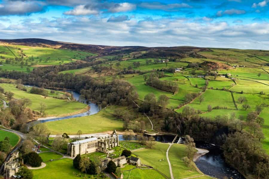
In the south of the national park, the 30,000-acre Bolton Abbey Estate is home to the handsome ruins of the 12th-century Bolton Priory, ancient oaks in Strid Wood and a seven-mile stretch of the River Wharfe.
There’s a map of the estate on the website, as well as some ideas for local walks, but we’d suggest that you try the five-mile loop along the river that takes in many of the estate’s main attractions. Starting at the Bolton Abbey car park, it begins by passing the priory and the famous stepping stones across the river that were once used by priory workers. From there you follow the course of the river as far as Strid Wood, where you’ll pass the narrow channel in the river that creates a series of rapids and small waterfalls and cross the Strid Footbridge before returning along the opposite bank. Look out for deer, otters, kingfishers and woodpeckers on the way.
Local tip: If you’d like to take a break en route there are plenty of places to stop for a picnic, including a river beach north of the stepping stones. The riverside Cavendish Pavilion serves drinks, light lunches and sandwiches throughout the day.
Fountains Abbey and Studley Royal Water Garden
Start/end: Fountains Abbey Visitor Centre
Distance: 4.5 miles (7km)
The beautiful UNESCO-listed Fountains Abbey and Studley Royal Water Garden near Ripon includes the extensive ruins of a 12th-century Cistercian abbey, a glorious Georgian water garden and a deer park.
There’s so much to see here, including the abbey ruins, ornamental lakes, canals, statues and follies in the water garden, ancient limes, oaks and sweet chestnuts, and grassy lawns beside the River Skell. You can roam the estate to your heart’s content, but this 4.5-mile walk, with details and a downloadable map on the National Trust website, offers the chance to take in many of the main attractions.
Tip: The site is free to visit for National Trust and English Heritage members. Otherwise, a fee applies. If you’d like to learn more about the history of the abbey and gardens, there are also guided tours every day. Dogs (on leads) are welcome.
Hill and moorland walks
Brimham Rocks circular walk
Start/end: Brimham Rocks Car Park
Distance: 1.3 miles (2.1km)
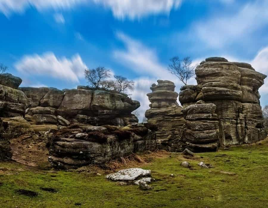
A National Trust site in the Nidderdale Area of Outstanding Natural Beauty, Brimham Rocks is known for its heather moorland and a series of dramatic weather-sculpted rock formations. The presence of a visitor centre, a car park and a snack kiosk make this short circular walk a great choice if you have children with you – and that’s before you include the excitement of all the clambering they can do.
The walk follows an easy trail from the car park and takes in imaginatively named formations including the Smartie Tube, the Eagle, the Dancing Bear and the Druid’s Writing Desk, among many others. Along the way there are dramatic views over Nidderdale and Dallowgill Moor, and towards York and Harrogate.
Tip: The National Trust website has a handy downloadable map of the site, and there are also paths here that are accessible to wheelchairs and mobility scooters.
Ingleborough circular walk
Start Point: Clapham
Distance: 10 miles (16km) looop
While we admit that this route to the top of Ingleborough is definitely more of a hike than a walk, it’s worth including here because it offers the chance to conquer one of the national park’s iconic Three Peaks, and is one of the most popular walks in the Yorkshire Dales. It’s unsuitable for younger children and climbs an impressive 600 metres, but if you pace yourself and carry plenty of sustenance, you’ll be rewarded with views of Pen-y-Ghent and Whernside (the other two peaks), fabulous panoramas across the park, and an enduring sense of achievement.
Starting from the village of Clapham, the trail climbs past the Ingleborough Show Cave – definitely worthy of a visit on the way back down, if you have time – and through the wooded limestone gorge of Trow Gill to the legendary Gaping Gill pothole, before following a circular trail over a ridge to Little Ingleborough and up to the summit itself, finishing by returning down to Clapham.
If you fancy taking on the challenge, the national park website has a handy downloadable map and description of the route, or you can try this one at Walks 4 All.
If you’d like to visit Ingleborough Cave, Gaping Gill or one of the other show caves in the park, there’s lots of useful information in Pitchup’s guide to caving in the Yorkshire Dales National Park.
Whether you want to stroll beside a river, wander the moors or bathe in the beauty of a UNESCO World Heritage Site, there are no end of great walks in the Yorkshire Dales to choose from. If you’re hungry for more, take a look at the National Park’s free walking app, which has details and maps for 35 great Yorkshire Dales walks.
Looking for somewhere to camp on your Yorkshire Dales walking trip? Check out Pitchup’s excellent collection of campsites in the Yorkshire Dales National Park, including everything from basic grass pitches to luxurious glamping units.