The Best Walks in the South Downs

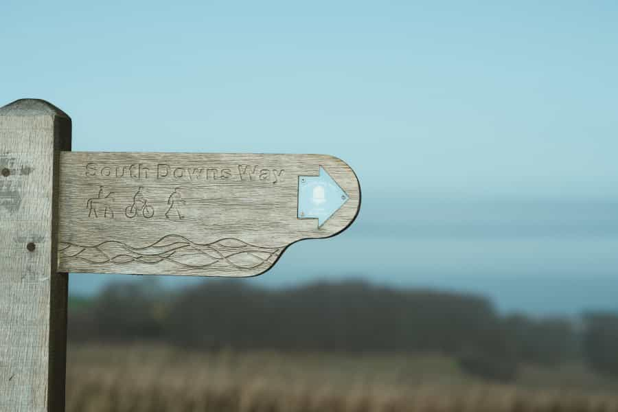
With miles of paths across chalk grasslands, through beautiful woodlands and along a dramatic coastline, including the 100-mile South Downs Way, the South Downs National Park is a great place to visit if you love a good walk.
Our guide to the best South Downs walks takes in a beautiful route along the Seven Sisters cliffs, canalside trails, tranquil forest paths and ancient sites, with some incredible views and the chance to spot local wildlife on the way. They’re all suitable for families and walkers of all ages, and we’ve included maps, descriptions and directions to make sure you don’t get lost.
The best walk in the South Downs
The Seven Sisters and Cuckmere Haven
Start: National Trust car park at Birling Gap
End: Seven Sisters Country Park Visitor Centre at Exceat
Distance: 3.7 miles (6 km) one way
Time: 2 hours
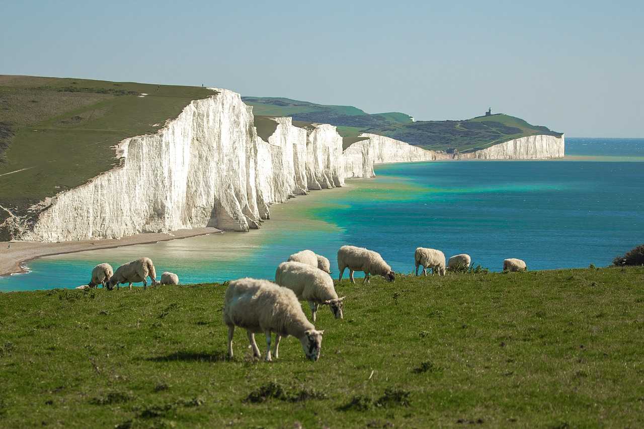
The beautiful Seven Sisters cliffs are an iconic sight of the national park, and if you’re only going to take one walk while you’re visiting, it should be this one. Taking in all seven cliffs, it starts at Birling Gap, then follows the South Downs Way all along the grassy clifftop, which is sprinkled with wildflowers in spring and has fabulous views of the coast and the surrounding countryside all the way. Look out for nesting kittiwakes and fulmars, and don’t forget to look back for views of Birling Gap and the Belle Tout lighthouse at Beachy Head.
When you reach Haven Brow (the seventh sister) and the mouth of the river at Cuckmere Haven, meander back through the water meadows and lagoons beside the river to the A259, where you can catch a convenient bus back.
It’s hard to go wrong here, but just in case, take a look at Countryfile magazine’s handy map of the route before you set off.
Easy circular walks in the South Downs
We like to make things as easy as possible for you ,so here’s a list of our favourite circular walks in the South Downs.
Woodland and countryside walks
Friston Forest
Start: Butchershole/Litlington car parks
Distance/time: Various circular walk options
Upstream from Cuckmere Haven, Friston Forest is a huge area of beech woodland honeycombed with well-marked trails for walkers and cyclists, with great views of the river and the South Downs. You can, of course, wander through the tranquil woodland to your heart’s content without following any particular set route, but Forestry England recommends two easy walks here that are suitable for anyone.
The easy, mile-long Butcher’s Trudge is a short loop from Butchershole car park on hard surfaced paths, with white footprint markers to show you the way, while the slightly longer White Horse View takes you from the Litlington Road car park along the edge of the forest to a ridge with views of the park, the surrounding downland and the white horse carved into the hillside at Litlington. There’s a map of both trails on the Forestry England website.
If this whets your appetite, there are plenty more trails in the forest, such as a 6.5-mile circular route on AllTrails that circumnavigates the whole area and takes you past the pretty village of West Dean, a great place to stop for lunch.
Kingley Vale Hidden Landscape Trail
Start Point: Kingley Vale Nature Reserve car park
Distance: 4.5 miles (7km) loop
Time: 3 hours
The Kingley Vale Nature Reserve is an area of chalk grasslands and woodlands dotted with ancient yew trees and Bronze Age burial mounds, with superb panoramic views of the South Downs.
From 2015 to 2017, the National Park Authority sponsored a laser-mapping project that helped reveal the hidden landscape around Kingley Vale hidden by the woods, and this walk takes in many of these features, including the Devil’s Humps burial mounds at Bow Hill and the Iron Age settlement at Goosehill Camp. If you’re a keen birdwatcher, keep an eye out for green woodpeckers, red kites and buzzards as you walk.
The South Downs National Park website has a great map and description of the walk with lots of historical information and details of everything that you can see.
Hill walks
Ditchling Beacon Circular
Start: Ditchling Beacon car park
Distance: 4 miles (7 km) loop
At around 250 metres high, Ditchling Beacon is the highest point in East Sussex. It's home to the remains of an Iron Age hillfort with panoramic 360-degree views south to the sea, and across the Weald and the South Downs.
This moderate 4-mile loop, which includes part of the South Downs Way, takes you over chalk grassland peppered with wildflowers with the chance to spot butterflies, kestrels and redwings, and rewards you with a view you won’t forget.
The South Downs website has a detailed map and description of the route, as well as two others that visit nearby Devil’s Dyke. At weekends and bank holidays, Breeze up to the Downs bus services from Brighton can deliver you to Ditchling in around half an hour.
![]()
Butser Hill Circular
Start: Queen Elizabeth Country Park
Distance: 3 miles (5km) loop
Time: 1.5 hours
Towards the west of the national park, Butser Hill is a nature reserve consisting of grassland, woodlands and chalk heath, and the hill itself is a Scheduled Ancient Monument.
An easy three-mile circular walk takes you to the top of the hill for memorable views, with the chance to spot bee orchids and cowslips, kestrels and butterflies on the way. There are a number of possibilities for which route to follow, including this one from AllTrails, and a slightly longer version courtesy of the South Downs Society.
Tip: Butser Hill is also a designated Dark Sky Discovery Site, so it’s a great place for stargazing or a romantic evening stroll too. For details of other stargazing sites in the park, take a look at Pitchup’s guide to stargazing in the South Downs National Park.
Canal walk
Wey and Arun Canal
Start: Loxwood Canal Centre
Distance: 5 miles (8 km) loop
This pretty loop along a well-maintained path takes in restored sections of the historic Wey and Arun Canal, passing locks and bridges that offer a glimpse into the park’s industrial past, and includes some beautiful countryside views.
It starts from the Canal Centre at Loxwood (open Wednesday and Friday to Sunday, 11am to 2pm), where you can pick up walking guides, maps and lots of useful information. The trail runs west along the canal, then turns inland to pass through woodland and open countryside before returning to the canal near the Drungewick Aqueduct (which you cross) and continuing along the towpath back to the start.
Tip: The Wey and Arun Canal Trust website has details of this walk and a number of others along the canal. It’s also possible to follow these on a canoe, a paddleboard, or (from spring to autumn) a guided boat trip.

Best historical and cultural walks in the South Downs
Arundel and Arundel Castle
Start: Arundel Museum car park
Distance: 4.5 miles (7 km) loop
Time: 2 hours
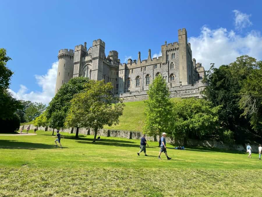
This easy loop walk is suitable for all ages and levels of fitness and takes you from the Arundel Museum through the wildfowl reserve at the Arundel Wetland Centre (which can be muddy) and around pretty Swanbourne Lake before returning to the start point. On the way there are great views of the castle and surrounding countryside, and you can look out for kingfishers, dragonflies and wild orchids at the wetland centre. If you fancy a rest and a cup of tea on the way, stop at Swanbourne Lake which has a tearoom and rowing boats for hire. AllTrails has a useful map of the route.
When you get back, it’s undoubtedly worth exploring Arundel Castle, with its Norman keep and grand state rooms filled with fine art and period furnishings, and beautiful 40-acre gardens which feature tropical, English and rose gardens, plus glasshouses, sculptures and fountains (fees apply).

Petworth Park Ancient Trees Walk
Start: Petworth Park North car park
Distance: 4 miles (6.4 km) loop
Time: 1.5 hours
Managed by the National Trust, Petworth House is an elegant 17th-century country house set in 700 acres of parkland designed by Capability Brown that includes a deer park.
This walk from the park’s northern car park follows a route that passes many of the estate’s ancient trees, taking in mature beeches, limes and aspens, oak trees including the 250-year-old Beelzebub Oak and another near the Pleasure Garden that’s estimated to be 940 years old, as well as many others that are hundreds of years old. Along the way you’ll visit Monument Hill, the highest point in the park, which has sweeping views of the estate, the South Downs and the Weald. You can admire the house itself from across the Upper Pond, and along the way you can look out for fallow deer and the jackdaws and starlings that love to nest in the park’s oaks and sweet chestnuts.
The National Trust website has a page dedicated to the walk with a map and a detailed description of the route. If you fancy something a little easier, you could try the Capability Brown Parkland Walk, a slightly shorter route in the opposite direction around the park.
Access to the parkland is free and, needless to say, the house itself – with its outstanding art collection – and the adjoining Pleasure Garden are also worthy of a visit (fees apply).
Practical tips for walking in the South Downs National Park
-
Always wear comfortable walking shoes and bring appropriate clothing for the weather.
-
Carry enough water and snacks for the duration of your trip, and a map or GPS file of the route.
-
Stay on marked paths and be mindful of the terrain.
-
Inform someone of your planned route and expected return time.
-
Follow the Countryside Code: leave no trace, respect the local wildlife and keep dogs under control.
-
Please take all your litter home with you or dispose of it properly.

Whether you want to gaze out to sea, explore historic landscapes or wander through the woods, our guide to the best walks in the South Downs has a route to suit you.
Camping is an excellent way to enjoy more of the park's fabulous scenery, so if you're looking for a place to stay check out Pitchup’s range of the best campsites in the South Downs.