Hiking in the Cairngorms
The shimmering lochs, salmon-rich rivers and rare Caledonian forests of the Cairngorms have inspired hikers and hillwalkers for generations. With a biodiverse and varied landscape like nowhere else, this stunning national park has some of the highest mountains and most remote environments in Britain, with hundreds of miles of footpaths to explore. This page covers the more challenging end of the walking spectrum, exploring the best hikes in the Cairngorms, how to prepare for your adventures and where you should look to base yourself to make the most of the local area.
Best hiking routes in the Cairngorms
There are almost endless possibilities for hiking in the Cairngorms, but we've picked out a few of our favourites to give you some inspiration.
The Lairig Ghru – a point-to-point walk that spans the Cairngorms from west to east
Distance: Up to 20 miles/30 kilometres
Ascent: 800 metres
Time: 1-2 days
Map: OL 57 - Grantown, Aviemore & Cairngorm Mountains
Public transport: Bus from Aviemore to Coylumbridge at the start of the route. No buses at the end (nearest public transport 4 miles away in Braemar)
The Lairig Ghru is a long but rewarding walk that stretches from the river Spey to the river Dee. While the path is mostly well maintained, the hike crosses very remote terrain and is far from any roads or infrastructure, so good navigation skills and fitness are required. That being said, given the length of the route, there is only a moderate amount of ascent involved (by the standards of the Cairngorms, at least), much of it through scenic Caledonian forest – the path then levels out and passes boulder fields, mountainsides and riverside sections.
It’s possible to complete this epic walk in just one day in the summer, but many prefer to wild camp to break up the journey (Corrour bothy is a good place to do this – it can fill up though, so make sure to have your own tent too). Alternatively, it is possible to park at the start of the walk and just complete a short section before turning back – you’ll still get sweeping views of the mountains and a good variety of landscapes, even if you just walk three or four miles out of Coylumbridge.
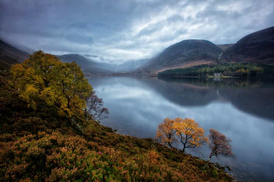
Loch Muick and Lochnagar – a peaceful loch and wild mountain that stand in stark contrast
There are two routes here, both of which are moderate in length. Located on the Balmoral Estate, the Loch Muick circuit is largely flat, while Lochnagar is an impressive Munro located just to the west.
Distance: 8 miles/12.5 kilometres (Loch Muick) or 12 miles/19 kilometres (Lochnagar circuit)
Ascent: 100 metres (Loch Muick) or 900 metres (Lochnagar)
Time: Up to 4 hours (Loch Muick) or up to 7 hours (Lochnagar)
Map: OL 53 – Lochnagar, Glen Muick & Glen Clova
Public transport: None available
Loch Muick (pronounced ‘mick’) was one of Queen Victoria’s favourite parts of the Balmoral Estate, but you don’t have to be royal to explore this stunning part of the eastern Cairngorms. Parking at the Spittal of Glenmuick car park, you can embark on a pleasant circular walk around the loch itself – keep an eye out for red squirrels, deer and oystercatchers along its shores. If you want to experience wild places but don’t want an overly strenuous day out, this could be the option for you.
Alternatively, you can head up into the hills and explore Lochnagar, a majestic Munro with stunning cliffs and a summit with views that extend far over Deeside. This is a serious walk with some very steep sections and involves negotiating a boulder field, but in good weather and with the right skills it can be a fantastic day out.
Cairn Gorm – the national park’s mountain playground
Map: OL 57 - Grantown, Aviemore & Cairngorm Mountains
Public transport: Regular buses from Aviemore and Glenmore run throughout the year
There are lots of ways up Cairn Gorm, including a funicular railway (check ahead if you plan on using this option, as it is often out of service). The summit itself is not particularly dramatic as it is located on a plateau, so many walkers like to combine Cairn Gorm with other routes. We’ve listed a few of the most popular variants below – all of them can be accessed via public transport thanks to the train station at Aviemore and connecting bus services to Glenmore and the Cairn Gorm car park.
-
Cairn Gorm summit
Distance: 5 miles/8 kilometres
Ascent: 600 metres
Time: 3-4 hours
This is the quickest route up Cairn Gorm. While many don’t consider it particularly scenic because of the ski resort infrastructure and funicular railway, there are still great views to be had along the way, including over beautiful Loch Morlich as you descend. The fact that you’re following the ski track and lifts most of the way also means this route requires only basic navigation skills when walked in good weather conditions.
-
Cairn Gorm via the northern corries
Distance: 7 miles/11 kilometres
Ascent: 800 metres
Time: 5-6 hours
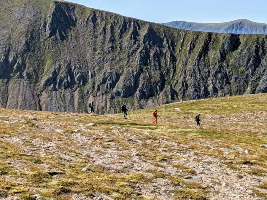
Avoiding much of the ski resort, this slightly longer route heads up to the summit before continuing further north and looping back to the car park via the beautiful Coire an t-Sneachda. You'll need to take care, especially on the final half of the walk, as there are cliffs and part of the route is pathless – sound navigational skills will be required, especially if the visibility is poor. This is a good all-round route for those who want to explore the mountain without too many crowds but don’t want to be tramping over the plateau for hours on end.
-
Ben Macdui via Cairn Gorm summit
Distance: 11 miles/18 kilometres
Ascent: 950 metres
Time: 8 hours+
If summiting two Munros in one day is on your bucket list, this walk to the second-highest peak in the UK should appeal. Once you reach the plateau, you’ll feel like you’re in a true wilderness – this vast and often featureless area can be difficult to navigate, so remember to keep checking your bearings. There’s a great sense of satisfaction to be had from completing this long walk, though, and if you’re lucky, you might spot ptarmigans, golden eagles and mountain hares, all of which live on the plateau and can be seen throughout the year.
-
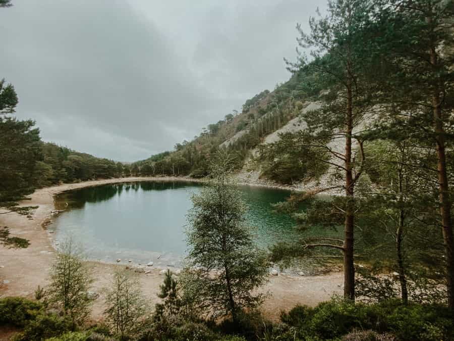
Loch Avon
Distance: 7 miles/11 kilometres (for an out-and-back route)
Ascent: 950 metres
Time: 7 hours (allowing time for a quick swim or rest on the beach)
This secret loch (pronounced ‘Loch ahn’, with a long ‘a’ like in ‘barn’) is a beautiful spot for a dip in the summer months. Adjacent to rivers and waterfalls, the loch (which has a small beach) can be accessed via the Cairn Gorm summit as an out-and-back route, but it is also possible to walk from Glenmore, along the river Nethy and then around the summit instead if you want a longer route. This option more than doubles the distance, but the amount of ascent is roughly the same – it makes a great two-day hike if you are planning on wild camping.
Essential hiking tips for the Cairngorms
Safety should be your number-one priority when exploring the Cairngorms. The whole area – and especially the top of the Cairngorm plateau – is very exposed to the elements and care should be taken.
-
Check the weather forecast using a number of different sources before you head out – the Mountain Weather Information Service produces a daily breakdown of exactly what conditions you can expect.
-
Let other people know exactly where you are going, especially if you’re pushing yourself. Youth hostels and outdoor activity centres like Glenmore Lodge (a couple of miles from the Cairn Gorm car park) will usually be happy to take a description of your route at reception – don’t forget to phone or drop by at the end of the day to confirm you made it back safely.
- While many people will take a phone for navigation, it’s always a good idea to have a back-up map and compass (and to know how to use it), or a second navigation device.
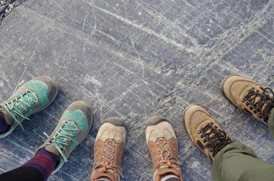
Pack the following equipment to make sure your hike is a success:
-
Waterproof clothing
-
Windproof clothing
-
A warm hat (yes, even in summer)
-
Sun protection, including sun cream (in summer, but also in winter when there can be glare from the snow)
-
A large bottle of water (plus water purification tablets if you are camping overnight)
The Cairngorms National Park Authority has produced a comprehensive practical guide to exploring the region – it’s a useful resource for further reference.
Starting points for Cairngorm hikes
It can be fairly difficult to travel between the east and west sides of the Cairngorms due to the mountainous terrain. Have a look at the hikes above or explore further possibilities using resources like WalkHighlands or AllTrails to help you decide which area you’d like to explore the most.
Speyside and the western Cairngorms have lots of good accommodation options for hikers – towns like Aviemore and Kingussie are home to lots of hotels, hostels and campsites, and wild camping is possible too in some more secluded areas. As it’s connected to the rest of Scotland by railway and the A9 road, this part of the national park is more accessible, including to visitors without a car. There are plenty of outdoor equipment shops in and around Aviemore if you need to stock up on kit; amenities like a large supermarket and restaurants are also available here.
Deeside and the eastern Cairngorms are also a great choice. The smart town of Ballater has a good range of outdoor accommodation options nearby and is only around an hour’s drive from Aberdeen. If you've come to see the royal estate or are interested in the region’s royal connections, you want to be on this side of the Cairngorms as it's closer to Braemar and Balmoral (both of which are about an hour and a half’s drive from Aviemore). Public transport is more limited here, although there are some buses along the A93 to Aberdeen – the flip side is that this area is generally a little quieter than the west.
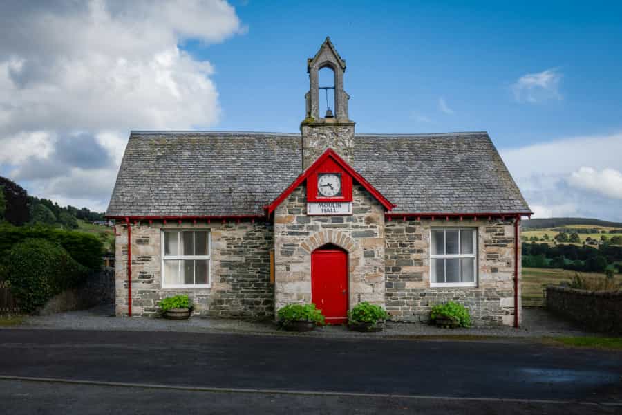
Pitlochry in Highland Perthshire, just to the south of the national park, is another good base for visiting both sides of the Cairngorms. Connected by road and rail to the western side of the park, and by road to the eastern side via Glenshee, it has the added advantage of being located just a few miles from the pretty Tay Forest Park.