Dartmoor Hikes
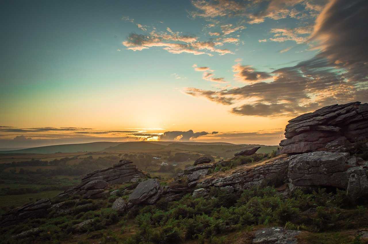
Encompassing 368 square miles (954 square kilometres) of wild moorland dotted with imposing granite tors and ancient archaeological sites, wooded river valleys and charming rural villages, Dartmoor was made for hikers. A huge choice of routes throughout the park caters for all levels of experience, from casual day walkers to experienced trekkers. Our selection of the best Dartmoor hikes features long and short routes for all abilities, from the 10-day, 108-mile Dartmoor Way to historic trails and a specially curated route from Visit Dartmoor with a downloadable audio description and music. All you have to do is choose the one that suits you best.
Best hiking routes in Dartmoor
If you’re itching to get going, read on to discover our pick of the best hikes on Dartmoor.
The Dartmoor Way
Distance: 108 miles (173 kilometres)
Time: Approx 7-10 days for the whole route
Difficulty: Intermediate
Route (anticlockwise from Ivybridge): Ivybridge to Shipley Bridge, Ashburton, Bovey Tracey, Moretonhamstead, Chagford, Okehampton, Lydford, Tavistock, Shaugh Bridge and back to Ivybridge
Waymarked all the way, this 108-mile circular route was created by the Dartmoor National Park Authority with the help of local businesses and walkers. It links towns and villages all around the edge of the moor, taking in bridleways, footpaths, rivers, waterfalls and open moorland, with great panoramic views and plenty of options for places to stay. Just some of the places to watch out for include Haytor Rocks, Buckfast Abbey, the ruins of 11th-century Okehampton Castle and the spectacular Meldon Viaduct.
If you have the time to hike the whole 108 miles, you’re very lucky, but of course it’s also possible to hike any of the individual sections in a day, as none of them are longer than 13 miles. The excellent official website provides a comprehensive breakdown of individual sections, with maps that you can download to your phone or GPS device. Komoot also has good maps, with useful descriptions of what to expect.
The Abbot's Way
Distance: 22 miles (35 kilometres)
Time: 8-12 hours
Difficulty: Intermediate (but quite long)
Route: Buckfast Abbey to Cross Furzes, Huntingdon Clapper Bridge, Stall Moor Stone Row, Nun’s (Siward’s) Cross, North Hessary Tor, Merrivale, Moortown and Tavistock Abbey
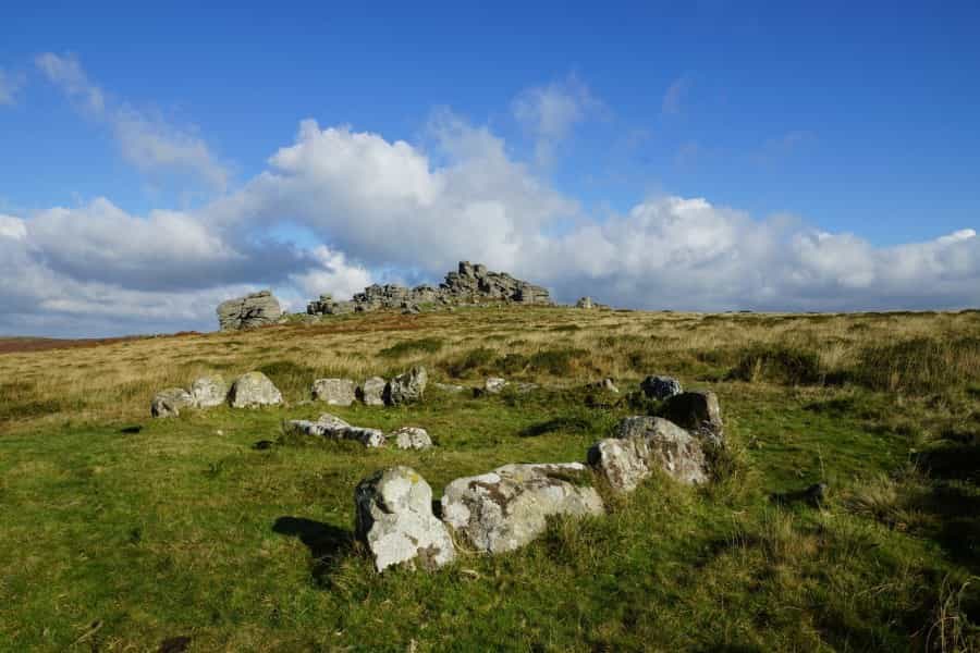
A fascinating choice for historians and archaeologists, the 22-mile Abbot’s Way is a historic monks’ path that runs east to west across the moor from the restored Buckfast Abbey (on a site dating to 1018) to the Benedictine ruins at Tavistock. It’s a great chance to get out onto some remote areas of the moor, with superb views from the high points around Princetown and North Hessary Tor. Along the way you’ll pass Stall Moor stone row and the Dancers Cairn stone circle, and at Merrivale you’ll come across more cairns and rows of stones dating back to the Bronze Age.
The length of this hike means that good preparation and plenty of energy are required. Due to its remote nature, not all of the path is waymarked, so access to a GPX download of the route is advisable. It’s also partly marked on Ordnance Survey map OL28 of Dartmoor.
If you’d like some company, The Tavistock and District Outdoor Education Forum runs an annual walk along the route every October, which often attracts several hundred participants. This account of the walk in 2022 on Visit Dartmoor is worth a read and has some good pictures.
A Ten Tor Circular Hike
Distance: 9.5 miles (15 kilometres)
Time: 3-5 hours
Difficulty: Challenging
Start point: Car park near the Dartmoor Inn, Lydford
Route: Arms Tor to Great Links Tor, Hunt Tor, Kitty Tor, Green Tor, Chat Tor, Sharp Tor, Hare Tor, Ger Tor, Doe Tor and Brat Tor
This fine circular route from AllTrails takes in 10 of Dartmoor’s famous granite tors. It can be boggy, and includes some steep climbs to the top of these striking granite outcrops, but you’ll probably forget all about them when you see the views. The last one you visit is Brat Tor, crowned by Dartmoor’s tallest cross, erected by William Widgery to commemorate Queen Victoria’s Golden Jubilee in 1887.
Please note, the route passes through the government’s Willsworthy firing range, so check the Dartmoor Firing Times website to make sure you’re in the clear before setting out.
Teign and Turrets
Distance: 8 miles (13 kilometres)
Time: 3-4 hours
Difficulty: Moderate
Start point: Chagford Square
Route: Chagford to Rushford Mill Farm, Dogmarsh Bridge, Teign Gorge, Castle Drogo, Fingle Bridge and back
This gorgeous eight-mile circular hike from Chagford along the idyllic Teign Gorge is a Pitchup favourite. It’s manageable for energetic kids as well as adults, and you can even have a swim on the way. The pub at Fingle Bridge serves food and is a great place to break your journey. It’s mostly easy walking, with a few tree roots and rocks to watch out for and one steep climb, but you’ll be rewarded with some incredible views from the Hunter’s Path near Castle Drogo.
If you’re a wild swimmer, a stop at the Salmon Leap on the Fishermen’s Path is a must. There’s a great (but chilly) section here where you can swim along among the trees, and the Salmon Leap itself is an energising natural jacuzzi (caution, not for young children).
This downloadable leaflet from Visit Dartmoor includes a comprehensive description of the route. You could also knock off a mile or two by just following the loop from Fingle Bridge car park.
Bellever Audio Walk
Distance: 6 miles (10 kilometres)
Time: 2-3 hours
Difficulty: Easy
Start point: Postbridge Visitor Centre
Route: Postbridge to Kraps Ring, Lakehead Hill, Bellever Tor, Laughter Tor, Laughter Hole Farm, Bellever Clapper Bridge, Postbridge Clapper Bridge and back to Postbridge
This short circular walk recommended by Visit Dartmoor offers something a little different, and couldn’t be easier to follow. It has an informative audio description to download that discusses the significant points on the way, featuring a musical soundtrack composed by local folk musician Seth Lakeman.
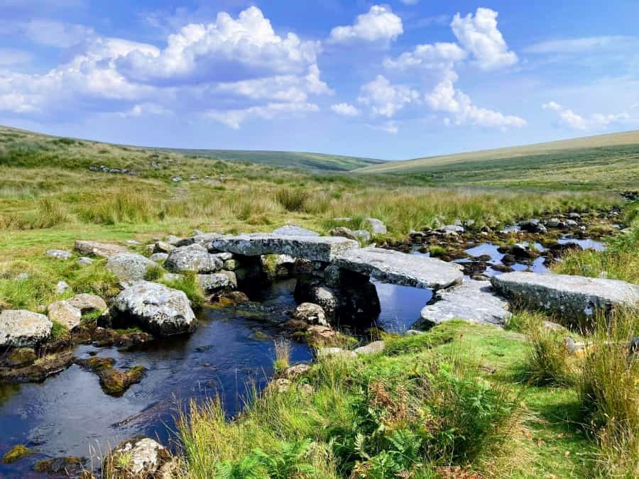
The route passes through Bellever Forest and over the moor past several archaeological sites, Look out for the remains of an ancient settlement at Kraps Ring, cairns and stone rows on Lakehead Hill, the delightfully named Laughter Tor, Dartmoor ponies and Postbridge’s medieval clapper bridge (formed by flat slabs of granite mounted on stone piers).
You can download the guide from Visit Dartmoor’s Audio Walks page. If you enjoy the experience, there are two more walks around Haytor and Princetown to try out too.
Practical tips for hiking in Dartmoor
Dartmoor’s weather can be temperamental and trail conditions, particularly on the more remote parts of the moor, can change quickly. Broadly speaking, the best time to hike in Dartmoor is between April and September. It’s possible to hike these routes in any season, but if you’re hiking in autumn and winter, please make sure that you’re well prepared.
Here are some simple safety tips:
-
Plan your route with care. Experienced hikers will already know that GPS (GPX) is your friend. Always download a file of your chosen route to your phone or GPS device. We’d also advise having a map and compass as a backup, and knowing how to use them.
-
Always check the weather forecast before you set out.
-
Dress appropriately for the conditions. Wear warm, breathable layers that you can add or remove easily, carry proper waterproof clothing and wear a comfortable pair of hiking boots.
-
Make sure to bring adequate food, snacks and water for the whole of your hike.
-
Carry a simple first aid kit, a fully charged mobile phone and sun cream (just in case).
-
Always let someone know where you’re going, and when you plan to be back.
-
Respect the environment and always follow the Countryside Code. Please take your rubbish home with you and leave no trace.
We hope that you’ve found something to tempt you among our choice of the best Dartmoor National Park hikes. The park is a fascinating and rewarding place to explore, and there’s nothing better for your health and wellbeing than a good walk in the fresh air. Enjoy your visit.
If you prefer more of a gentle ramble than a challenging hike, check out Pitchup’s guide to Dartmoor walks.
If you’re looking for somewhere to pitch your tent, have a look at Pitchup’s selection of Dartmoor campsites.
If you’d like to walk with a guide, check out this list of local experts on the Visit Dartmoor website.
More resources: