Littlewhite Farm
 Ingen tilgjengelighet for øyeblikket på Pitchup.com
Ingen informasjon gitt fra eier.
Eier? - legg til informasjon i Manager-portalen for å beskrive hvor fantastisk campingplassen din er.
Enhetsyper og tilgjengelighet
Velg datoer så sender vi deg en e-post når det er tilgjengelig.
Ingen tilgjengelighet her for dine søkekriterier
Vurderinger
Ingen vurderinger foreløpig.
Funksjoner
Fritidsaktiviteter på stedet
Bar eller klubbhus Barneklubb Fisking Innendørs basseng Kveldsunderholdning Lekeplass Restaurant/Kafé på plassen Spillerom Sykkelutleie TV-rom Takeaway Tennis Treningssenter Utendørs basseng VannsportBekvemmeligheter på stedet
Badekar tilgjengelig Bærbart toalett Dusj tilgjengelig Familietoaletter Gratis WiFi Henting fra offentlig transport Hundepark Internettilgang Ispakkekjøling Kompost-toaletter Matbutikk Myntvaskeri Offentlig telefon Oppvaskområde Pub-toaletter Toalettblokk Tørkerom WiFiGrupper velkomne
Familievennlig Grupper av samme kjønn velkomne Motorsykkelvennlig Studentgrupper velkomneRegler
Bål tillatt Griller tilgjengelig Grilling tillatt Hunder tillatt Hunder tillatt hele året Nyttekjøretøy tillattTjenester
Fornybar energi Gassflasker tilgjengelig Ladefasiliteter Ladestasjoner for el-biler Resirkulering tilgjengelig Tømming av kjemisk avfallBekvemmeligheter i nærheten
Bar i nærheten Butikk i nærheten Hundelufteområde i nærheten Offentlig transport i nærhetenType
Bondegård Mini (1-10 plasser)Tilgjengelighet
Baderom: Stor romslig dusj Baderom: Stort romslig toalett Flatt område, ingen bratte skråninger Jevne, harde veier, som f.eks. asfalt Plass nær tilgjengelige baderom Tilgjengelig parkering ved plassenBeliggenhet
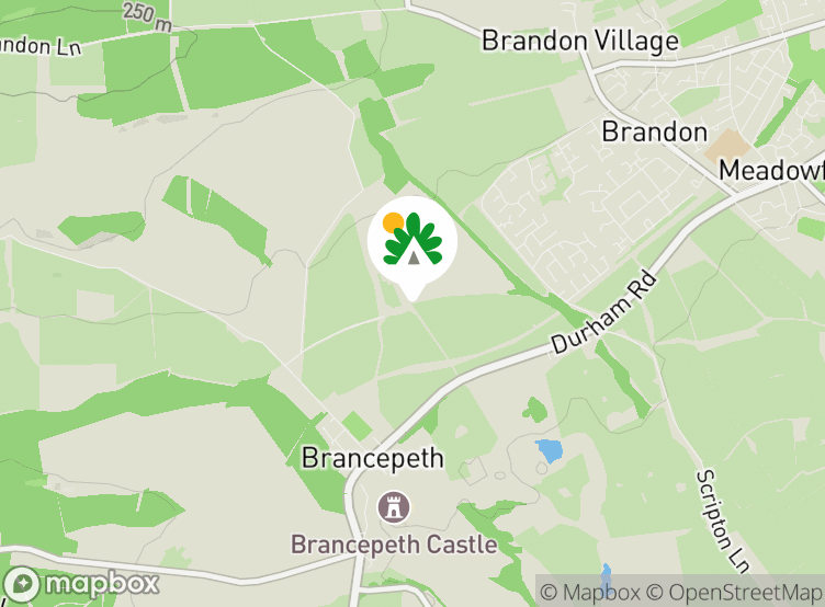
Littlewhite Farm
Brancepeth
Durham
Co. Durham
England
DH7 8DR
 Veibeskrivelse
Tidssone
Europe/London +0100 (GMT+01:00)
GPS
54,74335°N
1,65372°V
Veibeskrivelse av ruten
Nærmeste transport
 Buss
 Jernbane
 Ferge
 Flyplass
Legg merke til: Alle avstander på siden er beregnet i luftlinje – undersøk faktisk avstand basert på transportmetode og Få veibeskrivelse-knappen over.
Lokale attraksjoner
Mat og drikke
- The Brawn's Den Pub 0,8 km
- Bay Horse by Watson Pub 1,5 km
- The New Wok Inn Restaurant 2 km
- New Brancepeth Club Pub 2,8 km
- The Station Pub 3,3 km
- The Lord Boyne Hotel Pub 3,5 km
- The Flass Inn Pub 3,9 km
- The Black Horse Pub 4,3 km
- Stonebridge Inn Pub 4,3 km
- Cottles Pub 4,4 km
Dagligvarer
- Co-op Food Supermarked 1,8 km
- Aldi Supermarked 3,1 km
- Lidl Supermarked 3,3 km
- Tesco Supermarked 3,4 km
- The Co-operative Food Supermarked 3,8 km
- The Co-Operative Food Supermarked 4,4 km
- Maan Brothers Vinmonopol 4,4 km
- Co-op Food Supermarked 4,4 km
- Go Local Tweed Road Store Vinmonopol 5,8 km
- Iceland Supermarked 5,9 km
Parker og lekeplasser
- Addison Park 2,2 km
- Holliday Park 3,9 km
- Whitworth Hall Country Park 4,3 km
- Low Burnhall park 4,4 km
- Woodland Play Park Lekeplass 4,9 km
- Jubilee Park 5,6 km
- Allergate play area Lekeplass 5,8 km
- Newfield Millennium Green park 6,1 km
- Wharton Park 6,1 km
- Quebec Play Area Lekeplass 6,4 km
Familieutflukter
- Brancepeth Castle Slott 1 km
- Ushaw Historic House, Chapels & Gardens Turistattraksjon 5 km
- Durham University Botanic Garden Turistattraksjon 5,3 km
- Durham Cathedral Turistattraksjon 6 km
- Durham Castle Slott 6,1 km
- Diggerland Temapark 6,6 km
- Crook Hall Gardens Turistattraksjon 6,7 km
- Binchester Roman Fort Turistattraksjon 7,6 km
- The Eleven Arches Night Show - Kynren Turistattraksjon 8,2 km
- Auckland Castle Deer Shelter Turistattraksjon 8,4 km
- Adventure Valley Temapark 10,3 km
- Holmside Park Temapark 10,5 km
- Witton Castle Slott 10,9 km
- Hall Hill Farm Temapark 11 km
- Lumley Castle Slott 13,9 km
Offentlig transport
- Little White Farm 0,4 km
- Ashbrook Close 0,6 km
- Morley Wood 0,7 km
- Village 0,8 km
- Scripton Farm 0,9 km
- Alder Park-Beech Park 1 km
- Grove Rd (Clover Laid) 1,1 km
- Briar Avenue-Blackthorn Close 1,1 km
- Briar Avenue-Bell Meadow 1,2 km
- Stockley Lane End 1,3 km
Hva skjer i nærheten?
- Brancepeth Castle Golf Club Golfbane 1 km
- Durham City Golf Course Golfbane 3,5 km
- Aldin Grange Lakes Fiske 4,6 km
- Crook Golf Club Golfbane 5,6 km
- Fishing Hide - Sanctuary Game Anglers Fiske 5,9 km
- Loft Nattklubb 6 km
- Jimmy Allens Nattklubb 6,3 km
- Klute Nattklubb 6,3 km
- Bohemia Nattklubb 6,3 km
- Bishop Auckland Golf Club Golfbane 8,5 km
Lokale tjenester
- The Co-operative Bank Minibank 3,9 km
- Lloyds TSB Minibank 4,4 km
- Post Office Minibank 5,9 km
- M & M Pharmacy Apotek 1,7 km
- Meadowfield Surgery Leger 1,7 km
- Instavolt Ladestasjon 2 km
- BP Bensinstasjon 2 km
- Brandon Pharmacy Apotek 2,3 km
- Meadowfield Clinic Leger 2,4 km
- Shell Bensinstasjon 3,7 km
- Millyard House Leger 3,8 km
- W. Smith Apotek 4 km
- Esso Bensinstasjon 4 km
Må oppleves
Durham Cathedral 5,9 km
Durham Castle 6,1 km
Locomotion:The National Railway Museum at Shildon 12,9 km
The Angel of the North 19,5 km
Gibside 20,2 km
National Trust
Washington Old Hall 19,7 km
Gibside 20,3 km
Holy Jesus Hospital 25,5 km
Cherryburn 28,1 km
Souter Lighthouse and The Leas 31,2 km
Sykkelruter
Finn lokale ruter i National Cycle Network - over 19000 km med sykkelruter.
Annet
Brancepeth - Tallyho Gate - Brancepeth 0,7 km
BRANCEPETH CASTLE 1,5 km
Oakenshaw Nature Reserve 2 km
BURN HALL 3,9 km
Sunderland Bridge - Whitworth Hall Country Park - River Wear 4,3 km
Legg merke til: Alle avstander på siden er beregnet i luftlinje – undersøk faktisk avstand basert på transportmetode og Få veibeskrivelse-knappen over.
Ofte stilte spørsmål
- Har Littlewhite Farm et svømmebasseng? Nei Se alle funksjoner
- Er Littlewhite Farm hundevennlig? Nei Se alle funksjoner