Moor Top Farm
This site does not currently take bookings here on Pitchup.com.
If you are the owner of this site, start taking bookings through Pitchup.com.
It's free, quick and easy!
 Add your business details
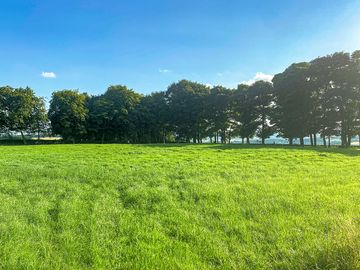
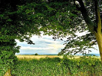
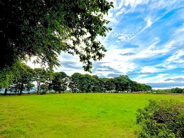
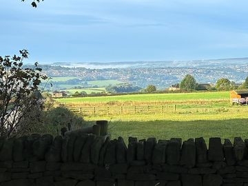
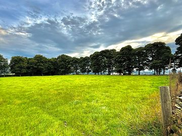
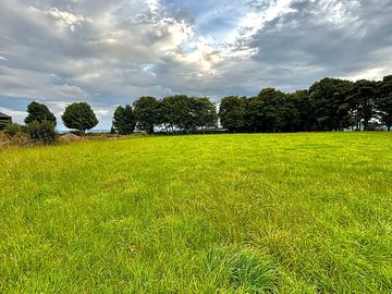
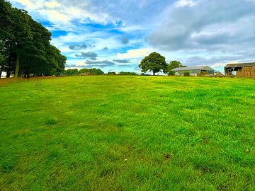
- Spacious site on a farm 20 minutes’ drive from the Peak District
- Chesterfield 20 minutes’ drive; Chatsworth House 25 minutes
- Dogs welcome; within walking distance of two pubs
Site type
 30
30 4
4Languages spoken
 English
Nearby sites that are bookable on Pitchup.com
Unfortunately, we have no nearby bookable sites.
Want to know more about camping in Derbyshire?
Features
'/%3e%3cpath%20d='M65.028%2031.697c-.183-.33-4.612-8.071-14.988-8.024-10.408.054-14.724%207.657-14.903%207.98a1.707%201.707%200%200%200%20.669%202.316c.272.15.566.211.856.206v43.736h26.872V34.225h.001c.935%200%201.705-.77%201.705-1.705%200-.288-.073-.571-.212-.823Zm-5.604%2039.041a3.144%203.144%200%200%201-3.126%203.125h-12.69a3.143%203.143%200%200%201-3.125-3.125V37.195a3.143%203.143%200%200%201%203.125-3.125h12.689a3.144%203.144%200%200%201%203.126%203.125v33.543h.001Z'%20style='fill-rule:nonzero'%20transform='translate(-34.924%20-23.673)'/%3e%3c/svg%3e) Portable toilet
Portable toilet
Dogs allowed
 Campfires allowed
Leisure on site
Bar or club house Cycle hire Evening entertainment Fishing Fitness centre Games room Indoor swimming pool Kids' club On-site restaurant/cafe Outdoor swimming pool Play area TV room Take away Tennis WatersportsAmenities on site
Bath available Car parking by pitch/unit Composting toilet Dog park Drying room Food shop Free wifi Ice pack freezing Internet access Launderette Parent & baby washroom Pick-up from public transport Picnic table Portable toilet Pub toilets Public telephone Shower available Toilet block Washing-up area WifiGroups welcome
D. of E. welcome Family friendly Motorcycle friendly Rallies welcome Single-sex groups welcome Student groups welcomeRules
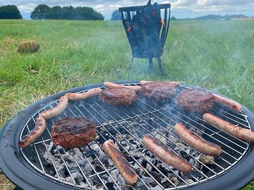
Barbecue provided Barbecues allowed Campfires allowed Commercial vehicles allowed Dogs allowed Dogs allowed all yearCamping 2.0
Jumbo tent pitchesThemes
Budget/backpacker Peaceful Remote location Spectacular scenery Walkers' paradise Wildlife havenUtilities
Charging facilities Chemical disposal Electric car charging point(s) Gas cylinders available Recycling available Renewable energyNearby amenities
Bar nearby Dog walk nearby Public transport nearbyType
Farm Medium (26-50 pitches)Nearby leisure
Canoeing/kayaking nearby Fishing nearby Horse riding nearby Indoor pool nearby Restaurant nearby Tennis nearbyLocation
Moor Top Farm
Moor Top Road
Apperknowle
Dronfield
Derbyshire
England
S18 4BN
 Directions
 Timezone
Europe/London +0100 (GMT+01:00)
GPS
53.30023°N
1.41787°W
Nearest transport
 Coach
Coach Rail
Rail Ferry
Ferry Airport
Please note: All distances on this page are calculated "as the crow flies" - please check actual distance depending on your mode of travel using the Get directions button above.
Local attractions
Food and drink
- Travellers Rest 0.5 km
- The Barrack 0.8 km
- The Inn at Troway 1.1 km
- Miners Arms 1.2 km
- Gate Inn 1.4 km
- Devonshire Arms 1.6 km
- Butchers Arms 1.9 km
- Fox and Hounds 2.1 km
- Horse And Jockey 2.4 km
- The Bridge Inn 2.5 km
Groceries
- Simply Drinks Off-licence 3.2 km
- The Beer Stop Off-licence 3.2 km
- Aldi Supermarket 3.9 km
- Sainsbury's Supermarket 3.9 km
- Job Lot Supermarket 4 km
- Heron Foods Supermarket 4 km
- Co-op Food Supermarket 4.1 km
- M&S Foodhall Supermarket 4.5 km
- Aldi Supermarket 4.5 km
- Aldi Supermarket 4.6 km
Parks and play
- Dronfield Nature Park 2.6 km
- Cliffe Park Playground 3 km
- Cliffe Park 3.1 km
- Lundy Road Playground 3.5 km
- Moonpenny Field park 3.7 km
- Moonpenny Playground 3.7 km
- Stead Street Play Park Playground 3.7 km
- Hilltop Playground 3.8 km
- Stead Street Play Park Playground 3.8 km
- Oakes Park 4.5 km
Family days out
- Graves Park Animal Farm Zoo 5.2 km
- Abbeydale Miniature Railway Visitor attraction 7.5 km
- Heeley City Farm Visitor attraction 7.7 km
- Ecclesall Woods Sawmill Visitor attraction 7.9 km
- Sheffield Manor Lodge Visitor attraction 8.3 km
- Rocky Ridge Railway Visitor attraction 8.6 km
- Wriggler Visitor attraction 8.7 km
- Grand Prix Racers Visitor attraction 8.7 km
- Gulliver's Valley Resort Theme park 9 km
- Sheaf Lightwell Visitor attraction 9 km
- Bolsover Castle 11.1 km
- Mayfield Alpacas Zoo 11.5 km
- Chatsworth House Castle 15.2 km
- Tropical Butterfly House Zoo 15.5 km
- Fun Park Theme park 15.5 km
Public transport
- Morton Lane 0.2 km
- Sharman Close 0.6 km
- Prospect Cottage 0.8 km
- Miners Arms 1.2 km
- Bramley Moor Quarry Hill 1.2 km
- Bramley Road 1.5 km
- Warren Crescent 1.5 km
- Crow Lane 1.9 km
- Loundes Road 2.2 km
- Eckington Road 2.2 km
Other nearby
- Bradleys Fishing Ponds 2 km
- Birchall Golf and Leisure Golf course 2.9 km
- Hallowes Golf Club Golf course 3.5 km
- The Forge Shopping centre 3.5 km
- Barrow Hill Driving Range Golf course 3.5 km
- The Forge Shopping centre 3.5 km
- Birley Wood Golf Club Golf course 4.5 km
- Dore and Totley Golf Club Golf course 5.3 km
- Littlemoor Centre Shopping centre 5.3 km
Local services
- Sainsburys Finance Cashpoint 3.9 km
- NatWest Cashpoint 4.3 km
- Barclays Cashpoint 4.9 km
- Total Fuel station 2.7 km
- Oakhill Medical Practice Doctors 2.7 km
- Peak Pharmacy 2.9 km
- Total Fuel station 3.1 km
- Peak Pharmacy 3.2 km
- Whittington Medical Centre Doctors 3.4 km
- Saviour Pharmacy 3.8 km
- Dronfield Medical Centre Doctors 3.9 km
- Jordanthorpe Health Centre Doctors 4 km
- Sainsbury's Fuel station 4.1 km
Must see
Bolsover Castle 11.3 km
Magna Science Adventure Centre 13.3 km
Hardwick Hall 15.8 km
Chatsworth 16.1 km
Hardwick Old Hall 16.3 km
National Trust
Hardwick Hall 16.4 km
Hardwick Estate: Stainsby Mill 16.4 km
Mr Straw's House 20.2 km
Winster Market House 23.1 km
Clumber Park 23.7 km
Cycle routes
Find local routes on the National Cycle Network - over 12,000 miles of cycling routes.
Other
OAKES PARK 4.4 km
RENISHAW HALL 4.9 km
BEAUCHIEF HALL 6.7 km
QUEEN'S PARK, CHESTERFIELD 7.6 km
Linacre Reservoir - Millthorpe - Oxton Rakes - Linacre 7.6 km
Please note: All distances on this page are calculated "as the crow flies" - please check actual distance depending on your mode of travel using the Get directions button above.
Reviews
No reviews yet.
Frequently asked questions
- Does Moor Top Farm have a swimming pool? No View all features
- Is Moor Top Farm dog friendly? Yes View all features
- What attractions are near Moor Top Farm? Visit the tap room at Drone Valley Brewery (five minutes’ drive) to sample the home-made offerings and support this community-led business. The volunteers who run it also organise monthly music sessions under … Read more
- When can I check in and check out of Moor Top Farm?
Camping and touring Arrive: 13:00 – 21:00 Depart by: 11:30 On-site accommodation Arrive: 14:00 – 21:00 Depart by: 11:30 Please call or text then campsite one hour before arrival to ensure the gate is open.
Read more