Cotgrave Club
 No availability at present on Pitchup.com


No information has been provided by the owner.
Site owner? - add information in the Manager Portal to describe how wonderful your site is.
Pitch types & availability
Choose your dates and we'll email when available.
No availability here for your search criteria
Reviews
No reviews yet.
Features
Leisure on park
Bar or club house Cycle hire Evening entertainment Fishing Fitness centre Indoor swimming pool Kids' club On-site restaurant/cafe Outdoor swimming pool Playground Recreation room/arcade TV room Takeout Tennis WatersportsAmenities on park
Bath available Composting toilet Dog park Drying room Free wifi Grocery store Ice pack freezing Internet access Laundromat Parent & baby washroom Payphone Pick-up from public transport Portable toilet Pub toilets Restrooms Shower available Washing-up area WifiGroups welcome
Family friendly Motorcycle friendly Single-sex groups welcome Student groups welcomeRules
Barbecue grills allowed Barbecue provided Campfires allowed Commercial vehicles allowed Dogs allowedUtilities
Charging facilities Dump station Electric car charging point(s) Propane/gas cylinders available Recycling available Renewable energyNearby amenities
Bar nearby Dog walk nearbyLocation
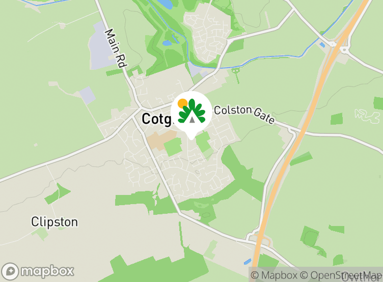
Cotgrave Club
woodview
Cotgrave
Nottingham
Nottinghamshire
England
NG12 3PJ
 Directions
Timezone
Europe/London +0100 (GMT+01:00)
GPS
52.90862°N
1.0341°W
Nearest transport
 Coach
 Rail
 Ferry
 Airport
Please note: All distances on this page are calculated "as the crow flies" - please check actual distance depending on your mode of travel using the Get directions button above.
Local attractions
Food and drink
- Manvers Arms Pub 0.7 km
- Rose and Crown Pub 0.8 km
- The Shepherds Pub 2.9 km
- The Wheatsheaf Pub 3.4 km
- The Chequers Inn Pub 3.5 km
- The Plough Pub 3.6 km
- Plough Inn Pub 3.9 km
- Perkins Restaurant 4.2 km
- The Yard of Ale Pub 4.3 km
- The Chestnut Pub 4.3 km
Groceries
- Booze Buster Off-licence 0.3 km
- Co-op Food Supermarket 0.3 km
- Heron Foods Supermarket 0.3 km
- Co-op Food Supermarket 4.3 km
- Morrisons Supermarket 4.9 km
- Co-op Food Supermarket 5.1 km
- The Co-operative Food Supermarket 5.4 km
- Co-op Food Supermarket 5.6 km
- Aldi Supermarket 5.9 km
- Morrisons Supermarket 6.1 km
Parks and play
- Ring Leas Play Area park 0.4 km
- Broadmeer Play Area Playground 0.7 km
- Cotgrave Country Park 1.5 km
- Keyworth Skatepark 4.4 km
- Geological walk park 4.4 km
- Geo-paving park 4.5 km
- Kinoulton Joint Use Play Area Playground 5 km
- Rockley Memorial Park 5 km
- The Cliffs park 5.1 km
- Valley Road Play Area Playground 5.3 km
Family days out
- Naturescape Tea Room Visitor attraction 8.1 km
- Rushcliffe Country Park Labryinth Visitor attraction 8.4 km
- Tyre Maze Visitor attraction 8.5 km
- Stonebridge City Farm Visitor attraction 8.7 km
- City of Caves Visitor attraction 8.8 km
- Speakers' Corner Visitor attraction 9.3 km
- Nottingham Castle 9.3 km
- Funstation Amusement arcade 9.4 km
- Zero Latency VR Amusement arcade 9.4 km
Public transport
- Welfare P&R 0.04 km
- Little Meadow 0.2 km
- Candleby Lane 0.2 km
- Crosshill 0.3 km
- Woodview 0.3 km
- Lingford 0.3 km
- Ring Leas 0.3 km
- Cartbridge 0.3 km
- Colston Gate 0.3 km
- Bramble Way 0.4 km
Other nearby
- The Nottinghamshire Golf & Country Club Golf course 2.7 km
- Radcliffe-on-Trent Golf Club Golf course 3.8 km
- Stanton on the Wolds Golf Course 4.6 km
- Edwalton Municipal Golf Course 4.9 km
- Ruddington Grange Golf Club Golf course 7.7 km
- The Brickworks Nightclub 8.3 km
- The Model Nightclub 8.9 km
- NG-ONE Nightclub 8.9 km
- Ocean Nightclub 9 km
- The Irish Nightclub 9 km
Local services
- The Co-operative Cashpoint 0.3 km
- Sainsbury's Bank Cashpoint 0.6 km
- Bank of Ireland; Post Office Cashpoint 4.3 km
- Cotgrave Surgery Doctors 0.3 km
- Cotgrave Service Station Fuel station 0.8 km
- Fosseway Service Station Fuel station 1.9 km
- Spire Nottingham Hospital 3.5 km
- Cropwell Bishop Surgery Doctors 3.6 km
- Esso Fuel station 4.2 km
- Radcliffe-on-Trent Health Centre Doctors 4.2 km
- Well Pharmacy 4.3 km
- Radcliffe Pharmacy 4.3 km
- Shell Fuel station 4.4 km
Must see
The Lace Market Centre 8.8 km
Nottingham Castle 9.3 km
Wollaton Hall and Park 12.6 km
Belvoir Castle 16.9 km
Ye Olde Pork Pie Shoppe 18.7 km
National Trust
The Workhouse, Southwell 20.2 km
Grantham House 26.4 km
Woolsthorpe Manor 29.2 km
Staunton Harold Church 30 km
Calke Abbey 31.6 km
Cycle routes
Find local routes on the National Cycle Network - over 12,000 miles of cycling routes.
Other
HOLME PIERREPONT HALL 4.8 km
MEMORIAL GARDENS, NOTTINGHAM 7.6 km
Old Market Square Nottingham - Wollaton Hall - Nottingham 9.2 km
HUNGER HILL GARDENS, STONEPIT COPPICE GARDENS AND GORSEYCLOSE GARDENS 9.4 km
GENERAL CEMETERY 9.9 km
Please note: All distances on this page are calculated "as the crow flies" - please check actual distance depending on your mode of travel using the Get directions button above.
Want to know more about camping in Nottinghamshire?
Frequently asked questions
- Does Cotgrave Club have a swimming pool? No View all features
- Is Cotgrave Club dog friendly? No View all features