Mountain Biking in the Yorkshire Dales
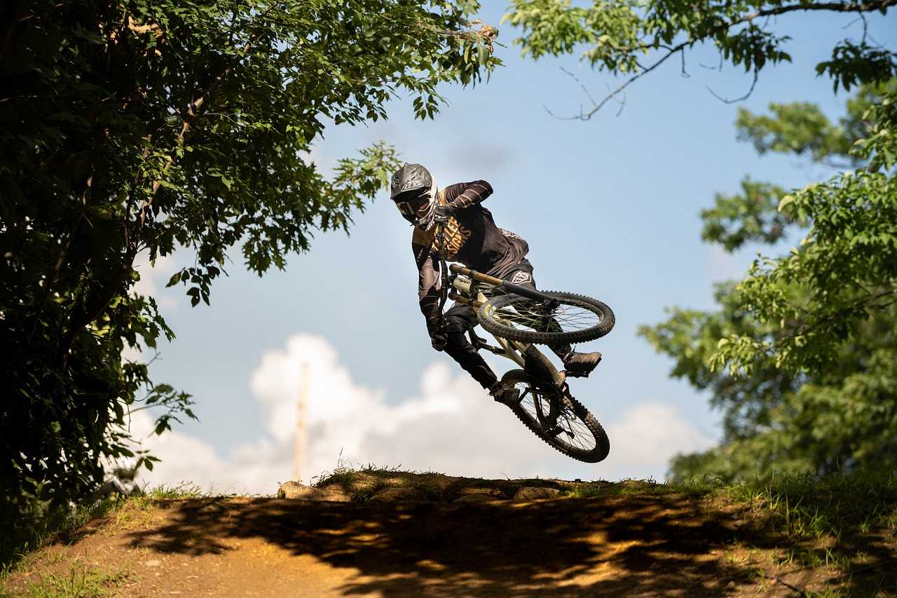
With miles of bridleways, remote moorland tracks, Roman roads and steep-sided river valleys, it's almost like the Yorkshire Dales was made for mountain biking. If you’re planning an MTB holiday here, you’ve made a wise choice.
Our guide to the best mountain bike routes in the Yorkshire Dales has options for all levels of fitness and riding ability, taking in testing off-road tracks, gentle riverside paths, dedicated forest trail centres and one of the Dales’ highest peaks, with dramatic glacial features, limestone landscapes and incredible views all the way. There’s also lots of useful information to help you plan your trip.
Off-Road trails in the Yorkshire Dales
Cam High Road
Start/end: Bainbridge Green
Distance: 9.3 miles (15km) loop
Part of the Pennine Way, the Cam High Road is an ancient Roman road that’s a highlight for any mountain biker visiting the Dales, offering a mix of challenging climbs and exhilarating descents. Perhaps untypically for an MTB route, it’s also dead straight.
This short-ish but testing loop from Bainbridge is suitable for intermediate riders and starts with a steep climb up the Cam. It then continues with a high-speed grassy descent down the side of Wether Fell to Countersett before skirting the Semper Water Nature Reserve and returning to the start point. Along the way you’ll be treated to panoramic views of the Dales, possibly with the chance to spot paragliders launching from the summit of Wether Fell.
Komoot has a map and brief description of the route, and you can download a GPX file if you sign up. If this whets your appetite and you fancy a longer trip, the website also has more than 20 alternative routes that include the High Road as part of the ride.
Swaledale
Start/end: Fremington, near Reeth
Distance: Various loops ranging from 6.2 miles (10km) to 24.8 miles (40km)
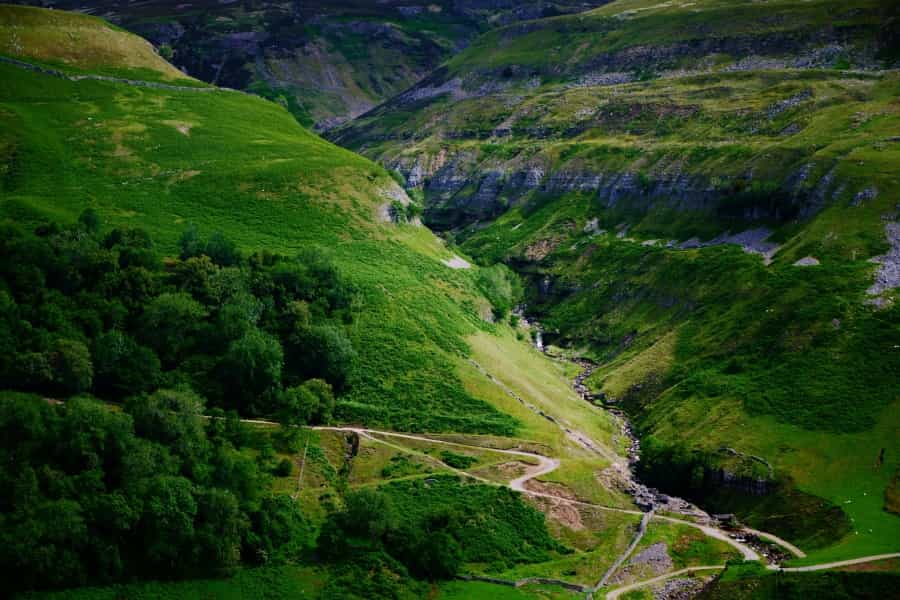
With gorgeous riverside scenery and a network of bridleways, singletracks and rocky moorland trails that offer a multitude of challenging MTB adventures, Swaledale is home to some of the best off-road biking in the Yorkshire Dales.
If you want to explore Swaledale (and who wouldn’t?), the Dales Bike Centre in Fremington is the place to start. If you’re here under your own steam and a confident navigator, they have a bike shop for any spares you’ve forgotten, plus helpful staff and route maps of the area. If you’re merely curious, you can hire bikes (including e-bikes) or even book a guided trip.
Rides here range from the Swale Trail – an easy 12-mile (20km) route along the river valley between Reeth and Keld that’s suitable for beginners and families – to a classic 25-mile (40km) loop with fabulous views of Gunnerside Gill. Expect lots of climb and fast steep descents but little mud, thanks to the well-drained limestone rock that underlies the valley.
If you’re itching to get started, check out some of the suggested routes from the Dales Bike Centre (with GPX files), or Komoot’s Swaledale page, which has a comprehensive list of routes around the valley compiled by MTB veterans.
Tip: Parts of the area are fairly remote, so make sure you have a map, a GPX file and enough supplies for the duration of your ride.
Hetton to Malham Moor
Start: Hetton
Distance: 11.7 miles (19km) loop
Sometimes you want lung-busting climbs and a real technical test, and sometimes you just want to enjoy the view. For the latter, this scenic countryside loop from Hetton is steady but can sometimes be muddy, following bridleways and grassy tracks (with just one short tarmac section). It's worth it though, as you’ll be rewarded with some of the best views the Dales has to offer.
It starts with an easy climb up the bridleway from Hetton before you join a grass track downhill with great views of Winterburn Reservoir. Next comes the principal climb, up the hill to the summit of Weets Top, where there’s a fabulous 360-degree panorama over the park. From here, it’s a short but steep downhill to the old monastic route of Mastiles Lane and across Boss Moor, with more great views of the limestone pavements around Malham Cove and Gordale Scar, then back to base. Watch out for the cows as you cycle, as they can wander onto the paths from time to time.
The MTB Dales website has a good map and description of the route, with a GPX file and pictures.
Yorkshire Dales MTB trail centres
Stainburn Forest
Start: Norwood Edge car park
Red Route 1.25 miles (2km): Short but intense with technical features and steep climbs.
Black Route 1.9 miles (3km): Extremely challenging with rock gardens and drop-offs.
In the south-east of the park near Nidderdale, this compact trail centre is known for its short but technical and demanding trails, which are rideable all year round.
The Red Loop is a singletrack loop through the forest; the Warren Boulder Trail (experts only) is a narrow, rocky singletrack with steep climbs, descents and highly technical obstacles; and the Descent Line is a short fast descent. All of them are waymarked but they're best suited to riders with some experience. Although they’re short, they’re designed to be ridden more than once, with a variety of obstacles meaning there’s something new to discover on each ride.
Along the way you’ll get some great views of the surrounding countryside, and as an added bonus, you can look out for deer and red kites on the way round. If you’d like to know what you’re letting yourself in for, check out this video on YouTube.
The Forestry England website has useful information and a brief description of all three trails.
Local tip: Check local conditions and be prepared for a tough ride. There are limited facilities here, so make sure you have all necessary supplies and equipment with you before you set off.
Gisburn Forest
Start: Gisburn Forest main car park
Red Route 11 miles (18km): A technical trail with rock gardens, berms and jumps.
Blue Route 5.5 miles (9km): A more accessible trail with flowing singletrack and gentle climbs.
Just outside the south of the national park in the Forest of Bowland (and well worth the short trip), Gisburn Forest is a popular MTB hub with a range of exciting singletrack trails and forest roads to explore. There’s a car park and a café here, and bike hire is available on site.
Take your pick of rides ranging from Bottom’s Beck, a moderate 5.5-mile waymarked route for novices, to The 8, an 11-mile figure of eight route with blue (intermediate) and red (proficient) sections plus optional black (expert) detours. There’s also a skills loop where you can warm up before choosing your route, and if you’re an expert rider looking for a thrill, you can try the Hope Line and Leap of Faith, a short but sweet downhill descent, to end the day.
Forestry England’s Gisburn page has a comprehensive guide to all the rides on offer here, with a downloadable map. The Forest of Bowland website also has a downloadable guide to the area that features a map and lots of useful local information, including explanation of the trail grading system.
Other great Yorkshire Dales mountain bike routes
Pen-y-Ghent Circuit
Start: Horton-in-Ribblesdale
Distance: 16.5 miles (27km) loop
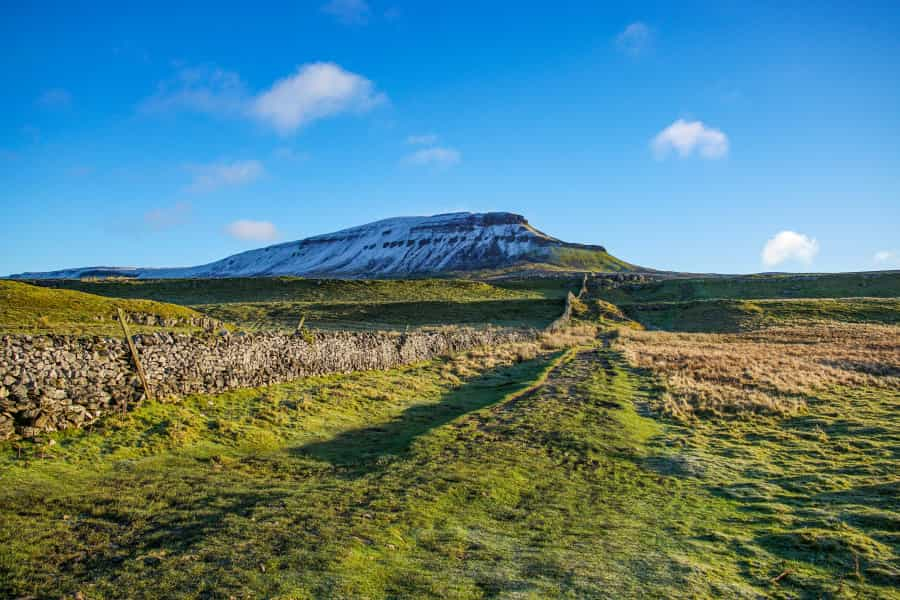
It would be a shame to visit the park without taking on one of the Dales’ renowned Three Peaks. This classic ride around Pen-y-Ghent, one of the best mountain bike loops in the Yorkshire Dales, takes in part of the Pennine Way, as well as lots of off-road sections on rocky pathways and grassy moorland. It requires a decent level of fitness, good preparation and some experience. This is a challenging ride and includes two particularly testing climbs, but if you’re up for the challenge you’ll be rewarded with some spectacular views of Ribblesdale and the peak, and you certainly won’t regret it.
The route starts with a short road section to warm up, then a climb to the shoulder of Pen-y-Ghent, before following the Dawson Close track down the side of the valley. After some tough climbs, you’ll join a grassy track to Hull Pot, a huge collapsed cavern nearly 100 metres long, then follow a stone track back to the start.
The Cycle The Dales website has a great map and description of the (anti-clockwise) route, with a GPX file and a map.
Local tips: This route is a great one for more experienced riders. The weather can change rapidly, so be prepared.
Clapham Tunnels and Bridges Loop
Start : National Park Car Park, Clapham
Distance: 12.5 miles (20km) loop
This scenic on- and off-road route travels through some classic Yorkshire Dales landscapes, taking in stone tracks, rock slabs, walled lanes, fords and clapper bridges, with a fabulous view from the highest point over the limestone pavement of Thieves Moss to Pen-y-Ghent.
Suitable for intermediate riders, it includes some gentle climbs and fast descents, and you’ll pass through some old railway tunnels and cross bridges with great river and valley views. Look out for the Norber erratics (giant glacial boulders) along the way, wildflowers in spring, and birds of prey riding the air currents above your head.
Cycle The Dales has a useful description of the route, with a downloadable GPX file and a map.
Brimham Loop
Start: Stif Mountain Bikes, Summerbridge
Distance: 10 miles (16km) loop
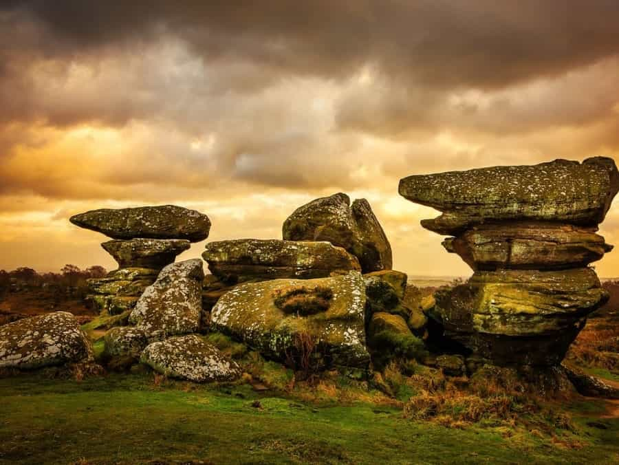
This moderately tricky ride is notable for its varied terrain, taking in woodland trails, quiet roads, bridleways, moorland and pretty valleys, finishing with a descent along an ancient packhorse route. There are great views of the Nidderdale National Landscape all the way, and Brimham Rocks, a fascinating National Trust site with many curious rock formations, is well worth a stop to explore. Stif Mountain Bikes in Summerbridge, where you can pick up any kit that you’re missing, is a very handy starting point and staff can offer expert advice on the route.
The Nidderdale website has a good downloadable map and description of the route, or you could try this one from Komoot.
Local tip: If you still have some energy after your ride and fancy a peep at the underground landscape here, you could follow the nature trail along Clapham Beck to visit Ingleborough Cave too.
Essential tips for mountain biking in the Yorkshire Dales
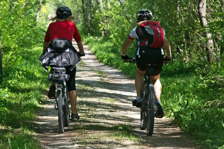
-
Always ensure your bike is in good condition before setting out. Check your brakes, tyres and gears.
-
Make sure you have enough water and snacks for the duration of your ride, a GPX file (and a map as a back-up) and a basic repair kit.
-
Always wear a helmet and appropriate protective gear.
-
Check weather conditions before setting out and be prepared for rapid changes.
-
Inform someone of your planned route and expected return time.
-
Respect the environment – follow the Countryside Code, leave no trace and stick to designated trails.
-
Please take all your litter home with you or dispose of it properly.
Whether you’re looking for an off-road adventure, a challenging forest trail or the chance to discover some of the park’s famous beauty spots, there’s a mountain bike route in the Yorkshire Dales for you. And if you'd like to experience more of that gorgeous scenery, Pitchup has an excellent collection of the best campsites in the Yorkshire Dales National Park, from simple farm sites to stylish glamping units for some comfort after a day in the saddle.