The Wild Boar Inn
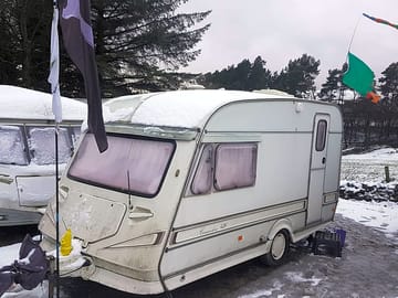
This campground does not currently take bookings here on Pitchup.com.
If you are the owner of this campground, start taking bookings through Pitchup.com.
It's free, quick and easy!
 Add your business details
No information has been provided by the owner.
Campground owner? - add information in the Manager Portal to describe how wonderful your site is.
Nearby campgrounds that are bookable on Pitchup.com
Unfortunately, we have no nearby bookable campgrounds.
Want to know more about camping in Cheshire?
Features
Dogs allowed
Leisure on site
Bar or club house Cycle hire Evening entertainment Fishing Fitness centre Games room Indoor swimming pool Kids' club On-site restaurant/cafe Outdoor swimming pool Play area TV room Take away Tennis WatersportsAmenities on site
Bath available Composting toilet Dog park Drying room Food shop Free wifi Ice pack freezing Internet access Laundry Parent & baby washroom Pick-up from public transport Portable toilet Pub toilets Public telephone Shower available Toilet block Washing-up area WifiGroups welcome
Family friendly Motorcycle friendly Rallies welcome Single-sex groups welcome Student groups welcomeRules
Barbecue provided Barbecues allowed Campfires allowed Commercial vehicles allowed Dogs allowedUtilities
Charging facilities Dump point Electric car charging point(s) Gas cylinders available Recycling available Renewable energyNearby amenities
Bar nearby Convenience store nearby Dog walk nearbyNearby leisure
Fishing nearby Golf nearby Indoor pool nearby Outdoor pool nearby Watersports nearbyLocation
The Wild Boar Inn
Wincle
Macclesfield
Cheshire
England
SK11 0QL
 Directions
 Timezone
Europe/London +0100 (GMT+01:00)
GPS
53.2036°N
2.0793°W
Nearest transport
 Coach
Coach Rail
Rail Ferry
Ferry Airport
Please note: All distances on this page are calculated "as the crow flies" - please check actual distance depending on your mode of travel using the Get directions button above.
Local attractions
Food and drink
- Wild Boar Inn Pub 1.2 km
- Ryles Arms Pub 2.1 km
- The Hanging Gate Inn Pub 2.3 km
- The Ship Inn Pub 2.5 km
- Rose and Crown Pub 2.6 km
- Harrington Arms Pub 3.5 km
- Leather's Smithy Pub 4.2 km
- Church House Pub 4.2 km
- St. Dunstan Inn Pub 4.3 km
- Sutton Hall Restaurant 4.7 km
Groceries
- The Food Warehouse Supermarket 5.1 km
- The Corner Plot Supermarket 6.5 km
- Bargain Booze Off-licence 6.7 km
- Co-Op Supermarket 6.8 km
- Aldi Supermarket 6.8 km
- Majestic Off-licence 6.9 km
- Tesco Supermarket 6.9 km
- Bargain Booze Off-licence 7.3 km
- Tesco Supermarket 7.3 km
- Sainsbury's Supermarket 7.5 km
Parks and play
- Lakeside Playground 3.3 km
- Robin Lane Park, Lyme Green 4.7 km
- Windmill Park 6 km
- South Park 6.2 km
- Brynmore Park 6.3 km
- St George's Park 6.3 km
- Congleton Road Linear Park 6.4 km
- Gawsworth Park 6.8 km
- Victoria Park 6.9 km
- Sparrow Park 7 km
Family days out
- Lud's Church Visitor attraction 4.3 km
- Gib Torr Rocks Visitor attraction 7.7 km
- Rudyard Lake Sailing Club Visitor attraction 7.9 km
- Rudyard Lake Sailing Club Visitor attraction 7.9 km
- White Nancy Visitor attraction 9.8 km
- Biddulph Grange Visitor attraction 9.9 km
- Biddulph Grange Gardens Visitor attraction 9.9 km
- Archie’s Farm Zoo 13.4 km
- Adlington Petting Farm Zoo 14.2 km
- Little Moreton Hall Castle 14.3 km
Public transport
- Wincle, Grounds / Primary School 1.7 km
- Wildboarclough, Nabs Road / Lower Nabs Farm 2.1 km
- Bosley, Leek Road / Dene House 3.4 km
- Bosley, Leek Road / Village Store 3.4 km
- Bosley, Leek Road / Conquest Plants Nursery 3.5 km
- Bosley, Leek Road / Crossroads 3.6 km
- Bosley, Leek Road / Bus Shelter 3.6 km
- Bosley, Leek Road / Smithy Lane 3.7 km
- Oakgrove, London Road / Fools Nook Inn 3.7 km
- Bosley, Leek Road / Minn End Lane 3.8 km
Other nearby
- Macclesfield Golf Club Golf course 5.3 km
- Scene Nightclub 6.7 km
- Fever & Boutique Macclesfield Nightclub 6.8 km
- Congleton Golf Club Golf course 8.8 km
- Marton Meadows Golf Course 9.5 km
- Kerridge Dry Dock Marina 9.5 km
- Tytherington Golf Club Golf course 9.5 km
- Treble Nightclub 10 km
Local services
- Lloyds Bank Cashpoint 6.9 km
- Lloyds Bank Cashpoint 6.9 km
- Nationwide Cashpoint 7 km
- Shell Fuel station 4.9 km
- London Road Pharmacy 5.5 km
- Well Pharmacy 6.5 km
- Cohens Chemist Pharmacy 6.6 km
- All Checked Up Clinic 6.7 km
- Lloyds Pharmacy 6.7 km
- Cohens Chemist Pharmacy 6.7 km
- Waters Green Medical Centre Clinic 6.8 km
- Cumberland House Surgery Doctors 6.8 km
- Esso Fuel station 7.1 km
Must see
Hare Hill Gardens (NT) 11.5 km
Capesthorne Hall & Gardens 12 km
Little Moreton Hall & Gardens (NT) 14.3 km
Lyme Park & Gardens (NT) 15.1 km
Royal Stafford 19.1 km
National Trust
Biddulph Grange Garden 9.9 km
Hare Hill 11.5 km
Nether Alderley Mill 13.6 km
Lyme Park 16.8 km
Winster Market House 30 km
Cycle routes
Find local routes on the National Cycle Network - over 12,000 miles of cycling routes.
Other
Lowerhouse - Sutton Common - Lowerhouse 2.5 km
Macclesfield Forest - Shutlingsloe - Macclesfield Forest 3.9 km
Trentabank - Shutlingsloe - Cat and Fiddle - Trentabank 4 km
Macclesfield Forest - Shutlingsloe - Wildboarclough - Macclesfield Forest 4 km
Macclesfield Forest - Forest Chapel - Macclesfield Forest 4.4 km
Please note: All distances on this page are calculated "as the crow flies" - please check actual distance depending on your mode of travel using the Get directions button above.
Reviews
No reviews yet.
Frequently asked questions
- Does The Wild Boar Inn have a swimming pool? No View all features
- Is The Wild Boar Inn dog friendly? No View all features